
Last year we went from winter to summer. I think we had a half afternoon of spring.
Not this year.
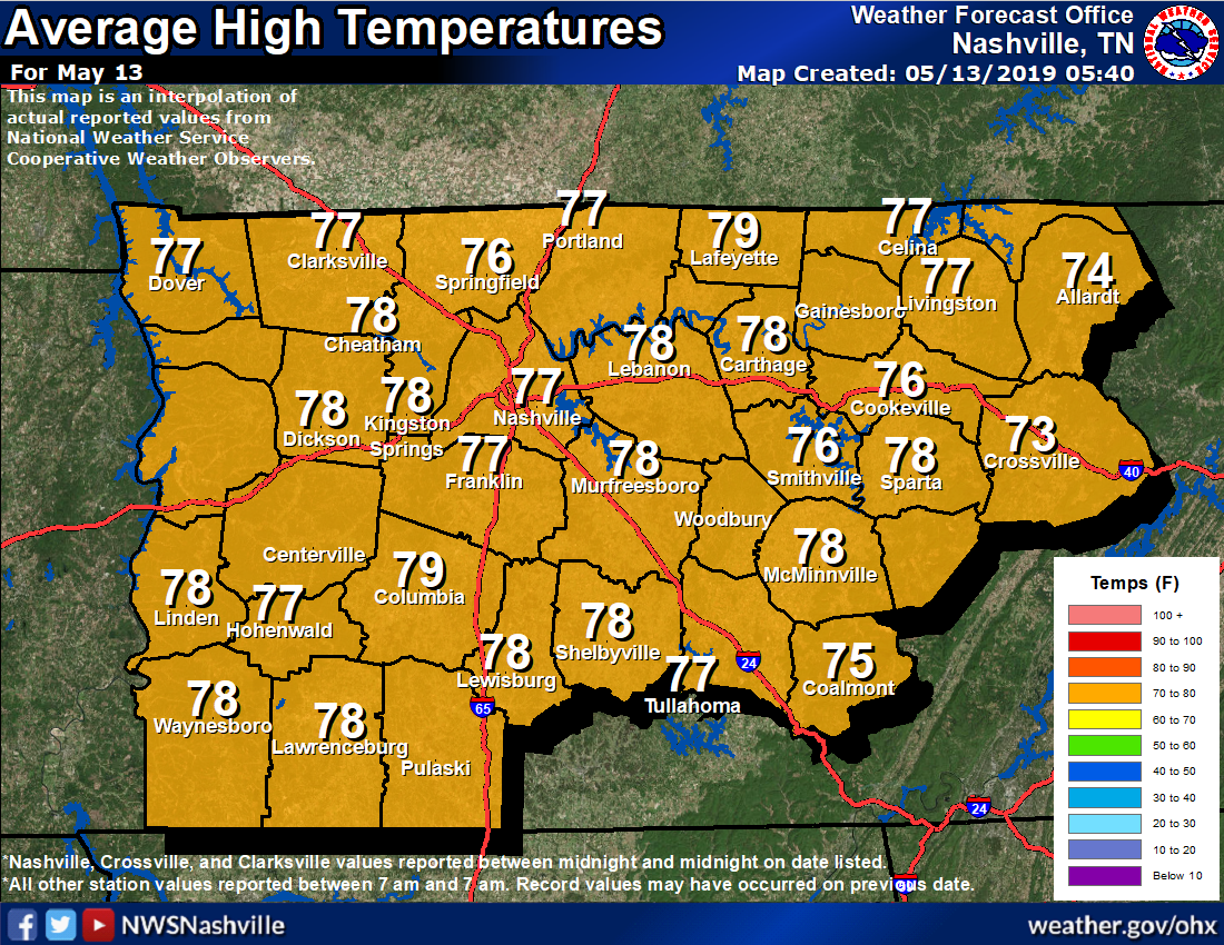
For example, over the past 24 hours the temp was 7° below average. Here’s where we’ve been:
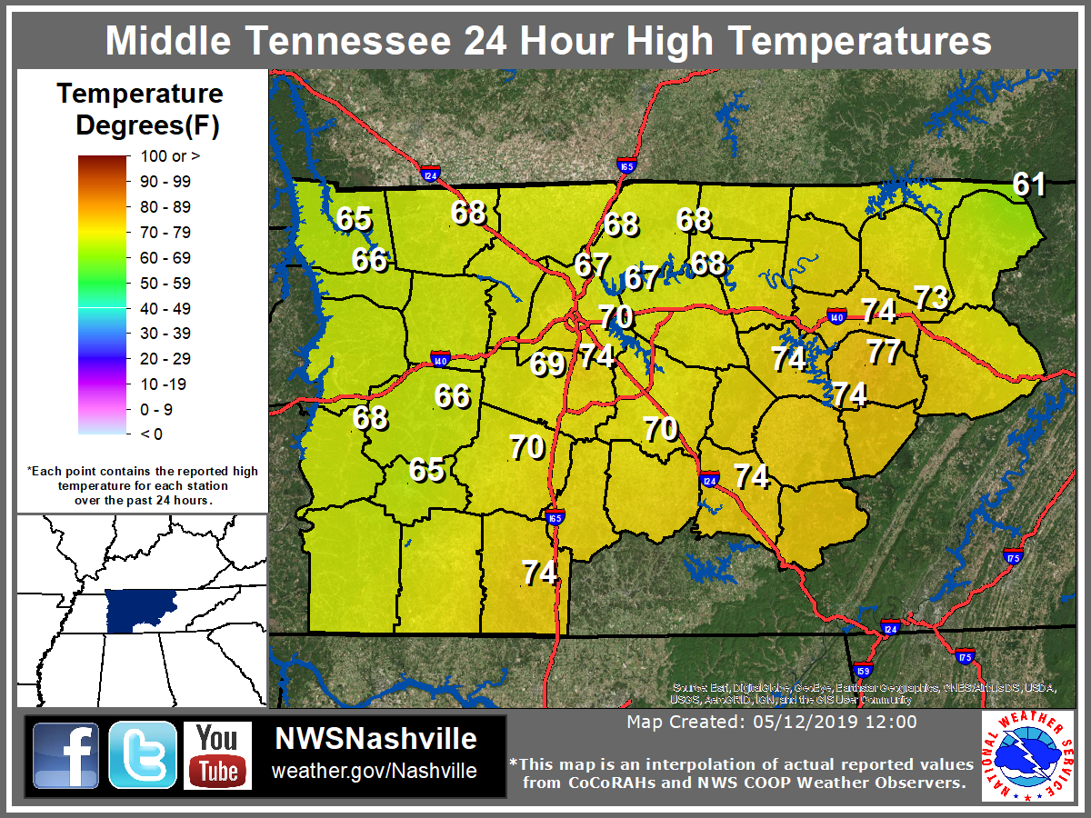
Average high, below:
Summer remains far away, which is totally fine by me.
Let Spring Be Spring.
Monday and Monday Night
A bit of a chilly start with temperatures in the low 50°s. Some patchy fog along the riverbeds, but this should mix out into the late morning. Skies should remain mostly cloudy, clearing into the evening.
High around 66.
Upper 40°s overnight low under clear skies.
Tuesday
More of the same. Morning fog, but more sunshine, and a bit warmer. We should reach into the 70°s.
Clouds will begin to move in that night, could see a stray shower or two.
Rest of the Week
Rain likely Wednesday, with a slight chance of non-severe thunderstorms Wednesday night. Just a rain event, no big deal. About 0.10″ or less, not enough for any/many rainouts.
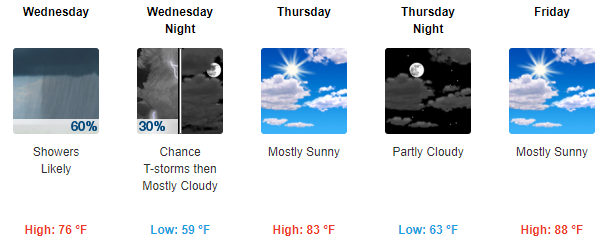
Warm up begins Thursday, temps reaching into the 80°s.
Expect a hot and humid weekend, though. Low/Mid 60 dewpoints with highs around 88 both days. Yikes.
Next real rain chance is poorly timed by weather models. Loose ETA late Sunday.
As always, check back for updates!

Categories: Forecast Blogs (Legacy)
You must be logged in to post a comment.