
Rain has departed. We got between 0.5″ and 1″, depending on your location.
Up next: cooler temps! Lower humidity!
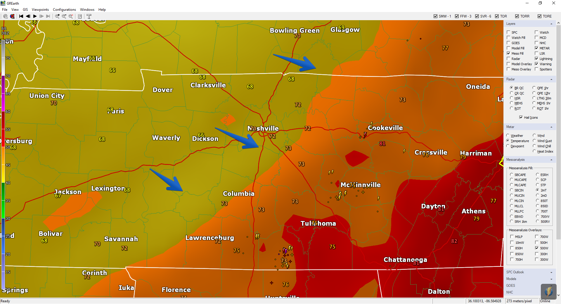
Cooler air is on the way, as seen here Sunday at 4 PM:
Clouds are expected Monday. They’ll be slow to clear out. But check out the cool temps!
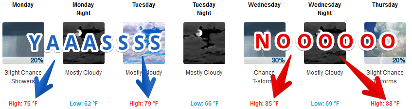
Don’t believe the clip art: rain is very unlikely Monday.
Humidity is also going to drop for a few days.

Early morning low 60°s Monday and Tuesday, so maybe you need your shawl or cardigan.
Hooray! Is Fall Here?
No.
Summer ends September 22.
Keep reading.

Summer Temps/Humidity Return Wednesday
Mid 80°s highs by Wednesday, breaking 90° by Friday or Saturday, with humidity rising to normal gross summertime levels. The usual “late afternoon/early evening pop-up” showers or storms will be possible Wednesday through the weekend.

About Florence
Like the rest of the weather world, we’re watching Florence with great interest and dread for our friends on the east coast. We hope it’ll curve north and bounce back out to sea.
There is no mention of Florence impacting our forecast, and until it does, we’re not adding our voice to the chorus because the Responsible Weather Community is doing great and we have nothing to add. Two great follows (among many) are:
@PaulHeggenWX
@nsj
Below is the current official NHC track. Expect this to change many times, perhaps dramatically. Draw no conclusions. Consult responsible sources. You know the source is responsible if they’re giving you a range of possible outcomes.
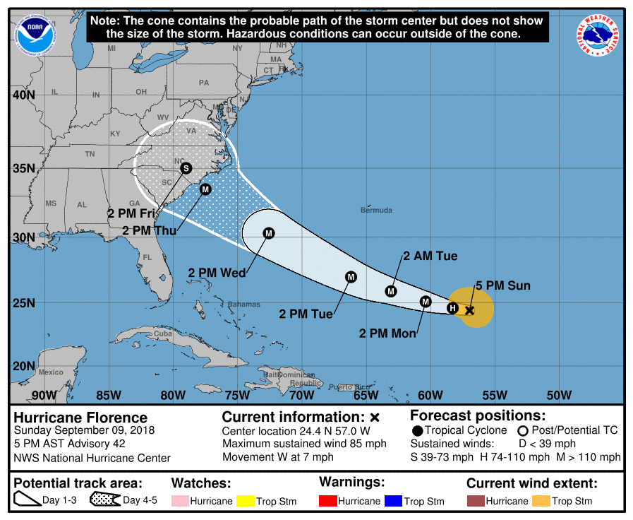
Florence should end up somewhere to our east. When that happens we end up getting a cool north breeze, with sinking air (which means very little/no rain or storms).

Categories: Forecast Blogs (Legacy)
You must be logged in to post a comment.