
Today’s lunchtime thunderstorm is prompting forecast changes. We thought tonight would be rainy/stormy, but it appears this big thunderstorm has taken all the fuel needed to maintain storms later today and tonight.
Now, we only expect a few light off/on showers as a cold front passes through. We do not expect a washout, but nevertheless stay connected to us and other reliable weather sources for any forecast changes.
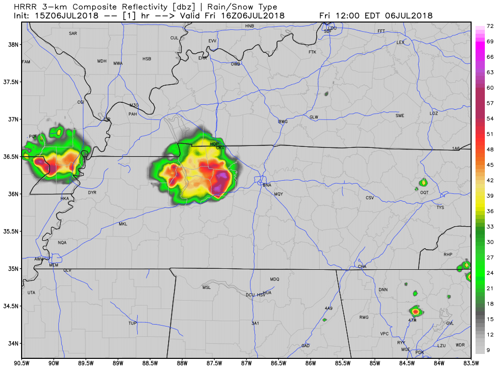
Here’s the latest run of the HRRR model showing the main complex moving out and only a few shower possible tonight:
Showers and thunderstorms will diminish by Saturday morning giving way to slightly cooler and slightly drier/less humid air. Enjoy it because it will not last long.
Saturday will be mostly great. Toward Saturday night, more humid air will get pulled in, providing the potential for scattered thunderstorms. This should be nothing like today’s rain and storms. It may not even happen.
Fortunately, we will not have to deal with unusual heat this weekend. Temperatures will be near normal through Sunday.
The Heat Returns Next Week

The long-term forecast does not look good. Next week, our highs will return to the low to mid-90s with dew point values making it feel like the low-100s.

To add more fuel to the fire (pun intended), the Climate Prediction Center’s outlook shows Nashville in the “warmer than normal” temperature range through August.
Click to @NashSevereWx on Twitter for updates!

Categories: Forecast Blogs (Legacy)
You must be logged in to post a comment.