
Below is an update from what we wrote this morning. It’s new information. But the same. Hot, Humid, Chance of Rain/Storms.
What We Know
Hot every day this week. Lower high temps mean more clouds and more humidity. That’s not comforting.
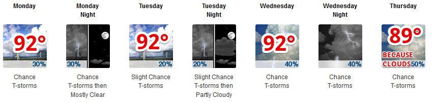
Remember forecast temps are for the shade. Direct sunlight = hotter than these numbers.

Yeah.
Humid. Oppressive in the morning, then on the upper end of Uncomfortable in the afternoon.

What We Think We Know
It should rain somewhere in Nashville or Williamson County. There will be plenty of storm fuel (Convective Available Potential Energy) sitting on top of us all, just waiting for:
(1) it to get hot enough to defeat high pressure and release the energy, or
(2) cold air coming from a nearby storm to kick-start the thunderstorm-making process.
We “think we know” this because it’s also possible these storms will miss Nashville and Williamson Co.
Storms won’t move much, and they should not last much longer than an hour.
Tornadoes are super unlikely. There will be no shear to spin them up. However, we have had weak tornadoes, called “shamnadoes,” in past summers, but again, tornadoes are very far down the list of storm concerns.
What We Don’t Know
We don’t know exactly where the storms will be. Your outdoor activity decisions should be guided by your risk tolerance and proximity to safety should a storm pop up. I think it’s more likely than not, each day, that the storms will miss you, but we can’t really tell you for sure.
We don’t know exactly when. Generally, though, storms are most likely during the hottest part of the day, ending after dark
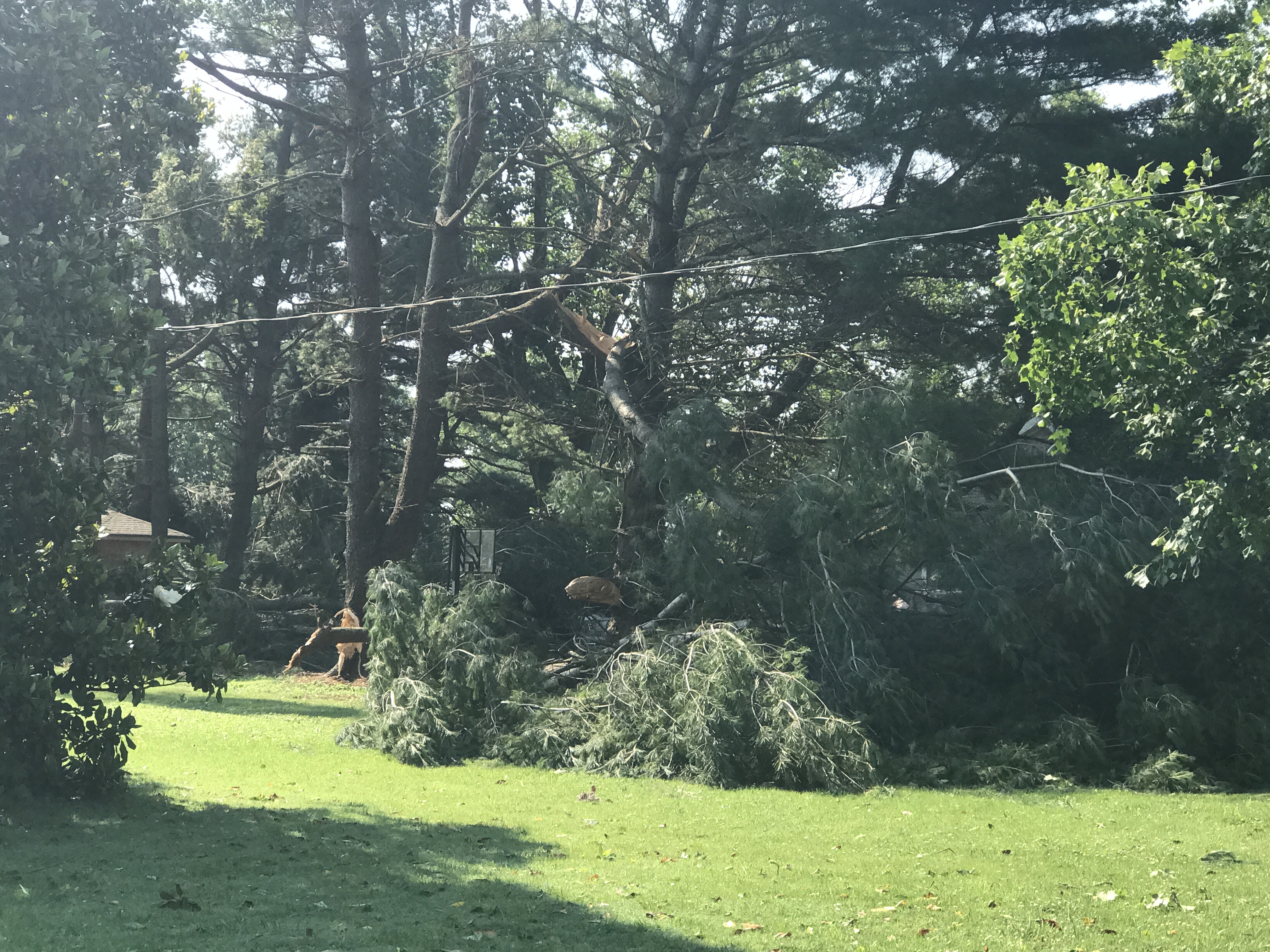
We don’t know how bad storms will be. Sometimes, they’re just rain. Most of the time there’s some lightning. Some storms can produce 30 MPH to 60+ MPH winds, with hail.
Examples from the last three days.
Sunday:
https://twitter.com/MeMyselfandRyan/status/1008446946284064770
@NashSevereWx This just happened at my neighbors house here in Bellevue!😳 pic.twitter.com/EDa7CHv7nt
— Tray Sea (@CrazyCatLady70) June 17, 2018
Saturday:
Time lapse of the hail/wind damage storm a bit ago over Woodmont Blvd. Looks microbursty. ^al pic.twitter.com/uSndf8cdCw
— NashSevereWx (@NashSevereWx) June 17, 2018
@NashSevereWx Hail on the West Side near Vandy. pic.twitter.com/rRk1233V1u
— Bernie (@Hey_Bernstein) June 17, 2018
Friday:
Just SW of Franklin
https://twitter.com/JosephHudak3/status/1007754459810877440
We will update the forecast as needed @NashSevereWx on Twitter. Not on Twitter? We have you covered.

Categories: Forecast Blogs (Legacy)
You must be logged in to post a comment.