
It’s uncertainty season.
Here’s one reason why ETAs and rain/no rain questions about your outdoor event are very difficult to answer with confidence.
Remember in elementary school when you were hopefully taught rain is basically just a tall cloud. The taller the cloud, the more water it has. When it gets tall and big enough, the water it has is too heavy to stay suspended in the cloud, so the water falls. That’s rain.
How does a cloud get tall? It’s hot, and heat rises, so you have rising hot air. When it’s humid, the rising air takes the humid, wet air up with it. A cloud forms. If it’s really hot and really humid, the cloud grows tall enough. Rain results.
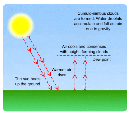
If the cloud gets super tall, and grows tall quickly, a thunderstorm can form.
Cloud formation faces one big enemy: high pressure, which is pressing down on the air trying to rise.
This is third grade science. Yet…
Predicting the future about where and when this process will occur is something science hasn’t figured out yet (hence the need to be responsible and “embrace uncertainty”). But the weather models sure try to figure it out.
Here’s the HRRR model. It thinks during the hottest part of the day today — late this afternoon, the high today is 91º — rain will finally break out and linger into the early evening hours: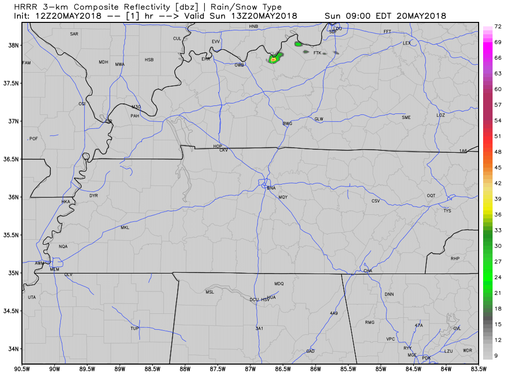
This model isn’t going to be exactly right. Storms may not form, or they may form somewhere else. The model is only a tool used in making a forecast. All models are wrong, some models are useful.
Any outdoor activity, especially late afternoon/early evening, needs to be responsive to rain and a thunderstorm chance. ETAs are very difficult because there is no system on the way, this is a “heat rises” set up, and there is nothing to track and time out to help with planning purposes.
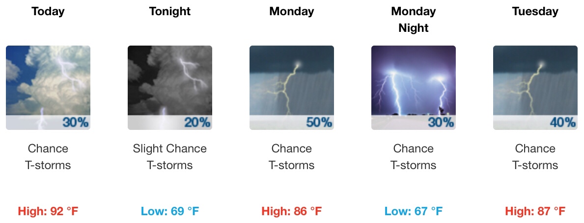
Rain More Likely Monday & Tuesday
Why? Because it’ll be more humid and it’s still going to be hot. Precipitable water values (PWAT) will be 1.6″ to 1.7″, which is a lot water for the atmosphere to tap. With plenty of heat both days, showers and storms should break out both afternoons and linger into the evening.
Exactly when or where is impossible to say, and it’s possible rain will miss us altogether, or dump 1″ on someone’s backyard. NWS Nashville splits the difference and forecasts 0.53″, but actual backyard rain totals will vary wildly in Davidson & Williamson Counties.
From NWS-Nashville:
Some localized flooding with slow moving cells looks feasible through Tuesday.
With more rain comes more cloud cover, so high temps should only top out around 87º or 88º.
Thunderstorms are also possible, especially Monday, but without meaningful shear (winds changing directions aloft) severe weather is not expected.
High Pressure Returns Wednesday & Thursday
Still, it’s possible heat will lift our humid air. Isolated showers and storms are possible (yet not likely). These are the two days most likely to be dry this week.
Friday & Next Weekend
High pressure will be replaced by low pressure, which will help along the process of rising air and improve rain and storm chances. Also, a tropical system may be trying to move in to the southeast next weekend. Rain chances Saturday are good.

Categories: Forecast Blogs (Legacy)
You must be logged in to post a comment.