
Current Official Hourly Observation (taken at :53 on the hour)

Current Radar Loop

![]()
Temps & Rain Probabilities Next 36 Hours (auto-updating)
—–4:00 PMUpdate—–
Late Tonight – Rain & Thunderstorms – Afternoon High 70, 10 PM 60
At 3:30 PM, rain and storms were firing up inside a Severe Thunderstorm Watch box in Texas and Arkansas:

That’s the system coming our way, with an ETA late tonight.

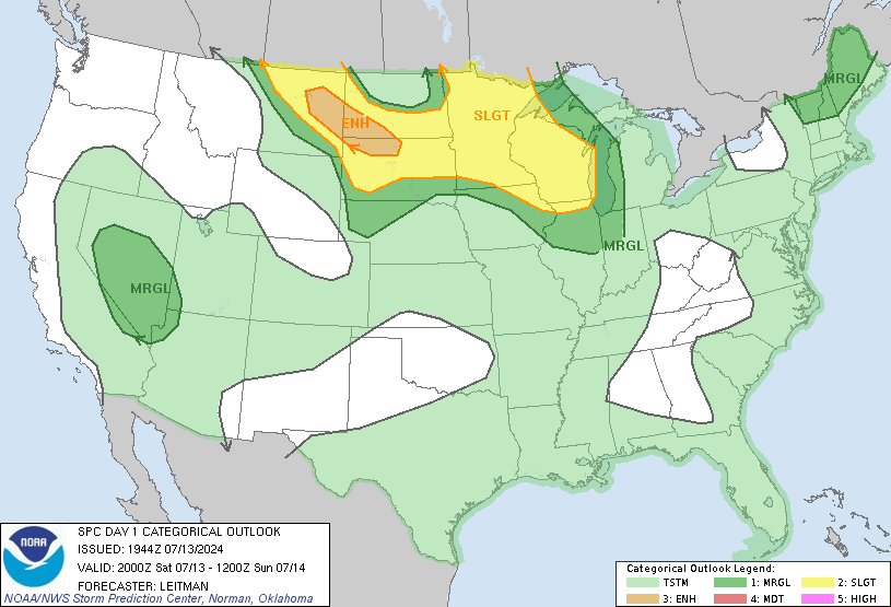
Storms may be strong on arrival, but they’re not expected to be severe. We remain outside the latest Storm Prediction Center’s “Slight” Risk outlook for severe weather:
An additional 0.55″ of rain is expected.
The rain should be gone by noon Saturday:

Saturday looks much cooler (high in mid-50s), but by Sunday, temps will rebound. The beginning of next week looks awesome.

There is some concern about a severe weather pattern setting up in Middle Tennessee sometime next week. Right now, it looks like Thursday, but we are too far away to pin down what (if anything) we’ll see, and when. Stay tuned.
This will be the last post Friday. Find more/updated information @NashSevereWx on Twitter.
Categories: Forecast Blogs (Legacy)