
7:55 PM Update
Current Official Hourly Observation (taken at :53 on the hour)

Temps Next 24 Hours (auto-updating)
Current Radar Loop

We see the precipitation coming, but how much of it will actually reach us? That is the GAZILLION dollar question.
Introducing “The Intern’s Gut!” A new segment brought to you by @NashSevereWx.
Because this forecast is so tough and “on the line,” some of you will feel this way toward me (The Intern) and that’s OK. It’s all part of the gig.

I’m gonna go out on a limb here and go with my gut!
(Editor’s Note: Alert! The Intern’s Gut is not an official forecast. It does not reflect the NWS forecast. It’s just his opinion. He could be wrong. But, he’s almost an actual meteorologist, so it’s time to let him make a call.)
You can kill me later if I get it wrong. I think Nashville will get around 1.5″ inches of snow. The further north you are, the less snow you’ll see.
(Editor’s Note: We hope you enjoyed the segment “The Intern’s Gut.” Please do not kill The Intern, now or later. Thanks!)
Why in the world are we so unsure about the snow that’ll be here in less than 24 hours? It will snow, or it won’t! Simple question! What’s the big deal?
The issues are:
1. Just about every model has a different opinion on how things will play out for us. Usually, the models fall in line and reach consensus within 24 hours of an event. Not so here. Some models predict no snow; others dump 3″ on us.
2. We are on the northern edge of this massive storm. The “edge” it will be so pronounced, it’s possible the south side of Nashville could see a couple inches, without the north side seeing anything at all.
3. There is no margin for error. A waggle this way, or a wiggle that way, by the low pressure center passing to our southeast will make all the difference.
4. We expect a good bit of dry air to be in place, waiting for the snow. So, even if the precip arrives, it’s questionable whether the Dry Air Monster will eat it up, preventing it from reaching the ground.
GFS (American) model Snow totals through Thursday 12am:

Canadian Model Thursday 12 am:

The European model which we can’t show has Nashville getting 2″ of snow.
The NAM, however, predicts no meaningful accumulation Wednesday through Thursday:

Officially, here’s the NWS forecast:
Any snow that does fall will stick and cause travel problems.
Additional information is available on Twitter @NashSevereWx.
2:30 PM NWS Conference Call Updates in blue (below, scroll on down)
Current snow cover in the US. It appears Jerry Garcia is over Lake Michigan:

Stop me if you’ve heard this one before.
It may snow tomorrow.

A fair point.
So, there’s this pretty big winter storm cranking up near the Gulf of Mexico. It’s going pass southeast of us, and clobber Alabama, Georgia, then ride up the east coast, spreading all sorts of wintry weather along the way. We’ll be on the extreme northern edge of this system.
Below is a “4 hour streak” from the NAM for tomorrow around noon:

As you can see, we’re on the extreme edge of this big storm. We think it’ll get really close without really biting us. Like this:
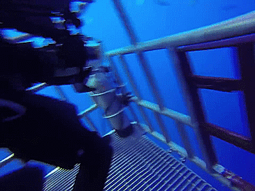
Obviously, in this helpful metaphor, we are the divers, the cage is the #SnowDome, and the shark is the snow sure to kill us all if it could just get a little closer (don’t worry, attractive people, if this happens you will all survive and be required to repopulate Nashville).
Our NWS says “Some light accumulation is possible in the Nashville metro area Wednesday and Wednesday evening.” Light accumulation means “only a dusting to…perhaps…up to an inch.”
During the 230 PM conference call, our NWS expressed how incredibly difficult this forecast will be for us. Models and other guidance continue to greatly disagree about how far north (toward us) the snow will get.
The further north you go, the bigger and hungrier the snow-gobbling Dry Air Monster will be. So, even if the precip makes it that far, it will have to contend with the DAM.
The next 4 images are hot off the press:


Model Snowfall Estimates:
- NAM 0″
- GFS 2″ (see below)

- Euro 1″ to 2″
However, it’s very important to emphasize: we are on the fringe of this system. A wiggle

to the north or south will mean the difference between nothing and 2″.
Right now, the forecast is for a dusting to 1″.
More significant accumulation is expected to our south and east. Those traveling east to Knoxville, southeast to Chattanooga, or south to Huntsville, should expect to encounter accumulating snowfall. Monitor reliable weather sources covering those regions.
The largely meaningless “snow depth” from the NAM (through 6AM Thursday) is a useful illustration of the #SnowDome it thinks we’ll see.

Remember, that’s just, like, one man’s opinion. It could be wrong.
The #SnowDome may die tomorrow.

Hmmmmmmmm.


More details coming tonight. Get more info on Twitter @NashSevereWx.
Categories: Forecast Blogs (Legacy)
You must be logged in to post a comment.