
Latest Official Hourly Observation:

Tonight – Cool & Cloudy – Overnight Low 47
We’ll be 15 degrees warmer than normal tonight. Clouds are gathering ahead of the big rain/storm system moving in tomorrow and over the weekend.
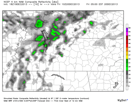
Friday – Rain – Morning Low 47 / Afternoon High 65
6a 49 . 9a 54 . 12p 62 . 3p 64 . 6p 63 . 9p 61
I’m jealous of all of you in Nashville. I’m freezing here in Canada.
(Editor’s Note: let’s all laugh at The Intern).
We could see a few light showers early in the day, but most of the rain will arrive overnight and through the rest of the weekend.
Hi-Res NAM model Friday 4 am – 1 pm:
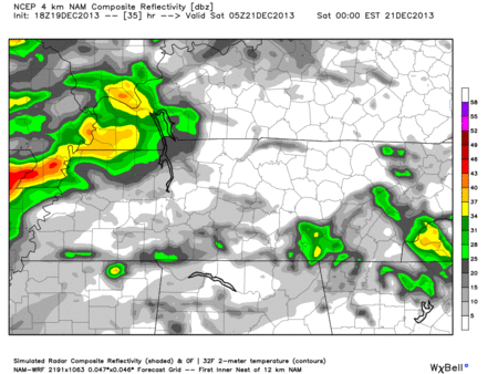
Saturday – Rain, Thunderstorms Late (Some Strong, Possibly Severe) – Morning Low 58 / Afternoon High 73
6a 59 . 9a 64 . 12p 70 . 3p 72 . 6p 69 . 9p 67
Very warm and windy day. It’ll feel like storms are coming. And they will be.
Winds could gust as high as 30+ mph.
SPC (Storm Prediction Center) does NOT include Nashville in its “Slight” risk outlook for Saturday.

However, there’s still a 5% chance of severe weather happening within 25 miles of you, most likely early Sunday morning. Main threat will be damaging winds.

Hi-Res NAM model Friday 11 pm – Sunday 12 am :
Our NWS thinks 3+ inches of rain is not out of the question.
WPC (Weather Prediction Center) has us right under 3 inches of rain through Sunday at noon:

Official NWS forecast:

Questions? We’re on Twitter @NashSevereWx.
Categories: Forecast Blogs (Legacy)
You must be logged in to post a comment.