
We’re Back!

I’ve weathered two crises* this week: the Cardinals losing to the Sox, and, even worse, the website crashing to earth like an innocent pop-up between Adam Wainwright and Yadier Molina (love you guys, but you have to own it). (*not actual crises, not even close).

This afternoon, I posted this synopsis of the severe weather set-up for today:

The storms in the purple box above haven’t been frightening. As of 3:45, there were no warnings on them.
The initial rain blob will depart after rush hour, followed by a break in the rain. Then, we’ll see if the storms in the purple box make it here.
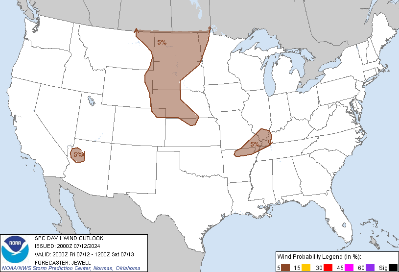
Our atmosphere is made up of several layers. The layer about 1,500 feet overhead is blowing at 60 mph. The downdraft part of any storm can transport those winds to the surface, so SPC included us in their Damaging Wind outlook. SPC says there is a 15% chance of a damaging wind event (58+ mph) happening within 25 miles of you:
Outside the storms, sustained winds are around 20 mph, with gusts maxing out at 40 mph (at the airport). With saturated grounds and high winds, weak/shallow rooted trees are coming down. A Wind Advisory is effective until 10 p.m.
This was our first report of the day, from Williamson County.

We’ve had several other reports of downed trees and telephone poles.
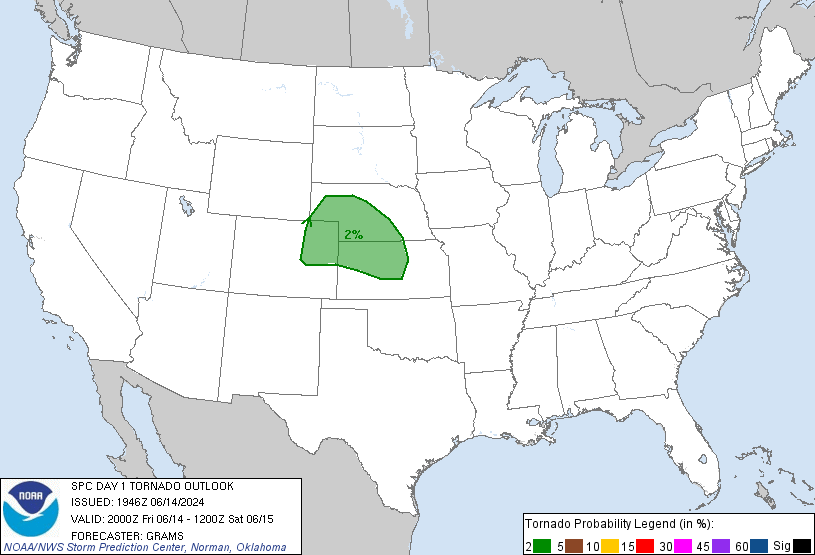
Substantial helicity (atmospheric “twist” or rotation) poses a very small tornado threat. Other important tornado-making ingredients are missing. In fact, we are just outside SPC’s 2% probability of a tornado (but no one is ruling it out):
I’ll be shocked to see any lightning or hail.
Look for this “next round” tonight after the initial rain blob passes. At 4:46 p.m., our NWS said “strong to severe storms still possible as we go through the evening, but probably not before 8 p.m.” In other words, any severe threat should arrive after 8 p.m.
We’ll update this forecast tonight exclusively on Twitter @NashSevereWx.
Friday – Clearing Out, Great Alternate Trick-or-Treating Night – High 70
We’ll wake up to wet grass and 56. Expect 66 by lunch, then 70 by mid-afternoon. Low 60s by sundown, 54 by 10 p.m.
The Weekend Looks Nice & Dry, But Cooler
Saturday: wake up to 46, then 59 by lunch, high 63, 54 by 7 p.m.
Sunday: wake up at 38, afternoon high of 59.
Categories: Forecast Blogs (Legacy)