First and Foremost, this post is brought to you by the makers of Mountain Dew, the only reason I’m currently seated upright. I’ve been up since 4 a.m., and my rule (which today seems ridiculous) is No Coffee After 2:30 p.m., so in order to function I reached for a Dew (it’s diet, for those of you concerned about me). This is my first soda in several months, and I’m drinking it fully realizing it’s the diet version of 19.25 teaspoons of sugar:

(There are side effects. For example, someone at work was asking about a “durable” power of attorney. All I heard was “gerbil.” Thanks, Diet Mountain Dew!).
Before we review July’s weather, a loving suggestion to Ye Earlybirds who choose to sit at the end of an empty row before what you know will be a crowded church service:
Please scoot to the middle of the row if possible.
I realize your on-timeliness qualifies you to sit where-ever you like, but consider that if you sit there, someone will eventually interrupt you during worship time to seek the only available seat in the middle of your row. Middleness is next to Godliness. After the service, your seat near the end will only guarantee you’ll hit every red light on the way home.
(Exceptions: Those with babies. Those concerned about the unusual breakfast they just ate. Ushers.)
To review, in a ten-seat row, where O denotes an open seat, and X an occupied seat:
Preferable: OOOXXXOOOO
Not Preferable: XXXOOOOOXX
I hope to arrive early to future services to demonstrate this protocol.
July In Review
Our average temperature was 77.8, which is 1.6 degrees below the 30 year normal. We made it to 97 (our high for the month) on the 17th. No temperature records were set.
We had our 17th wettest July on record (6.60″, which is 2.96″ more than normal). The wettest ever July was 9.43″ in 1878. Last July finished 4th all-time (8.38″).
We had 5 days with thunderstorms. The highest recorded wind gust in Davidson Co was 38 mph. Williamson County had higher gusts from the severe thunderstorm which caused structural and property damage in Franklin.
Well done, everyone.
Tonight
The Intern is interviewing for a paying job. In his absence, I strive to prepare a better “Oultook” than this:
Tonight
North winds, a few clouds, temps falling through the 80s into the 70s. There is a tiny chance of a puny isolated shower per the HRRR (the Abraham Lincoln of weather models), but do not bet on rain.
Patchy late night fog is possible. I was driving in that stuff this morning. I do not recommend it.
Friday – Some Sun, No Rain – High 89
7am 67 . 10am 79 . 1pm 86 . 4pm 88 . 7pm 76
Humidity will be unseasonably low.
Saturday
It may rain. Winds will turn around from out of the north to out of the south, pumping in humidity and a high of 90. Add to that a “southward sagging boundary to allow low slight probabilities of precipitation to return for the afternoon and into Saturday night.” (NWS 3:21 pm Forecast Discussion).
The 4-km-high-resolution NAM is an outlier. It predicts rain Saturday around 10 a.m.:

The European model has the better solution. It delays the precip until Saturday afternoon. NOAA’s Weather Prediction Center (WPC) thinks there will be some rain, but not enough to ruin outdoor plans.
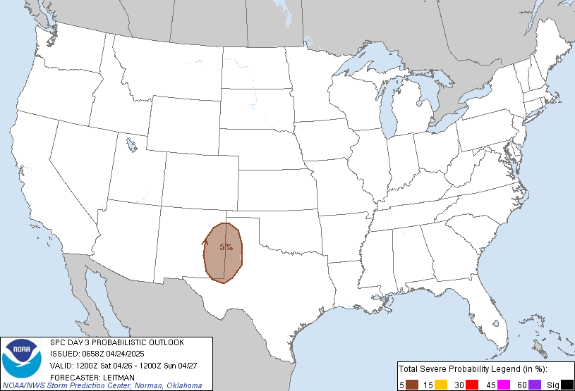
The Storm Prediction Center thinks there’s a 5% chance of strong/severe thunderstorms Saturday (see below). Widespread severe weather is not expected.

Sunday & Beyond
High temps will hover around 90 with typical August humidity.
WPC thinks it may rain a little every day next week.
Our NWS expects:
Scattered showers and thunderstorms … Each day across the Midstate from Sunday through Wednesday. A few storms could be strong each day with gusty winds and locally heavy rainfall… But no severe weather is anticipated at this time.
Categories: Forecast Blogs (Legacy)


You must be logged in to post a comment.