
Today – Scattered Thunderstorms – High 88
Today we were set up for widespread afternoon pop up thunderstorms, and that’s what happened.
Afternoon showers should diminish after sunset, only to be followed by another complex of storms to move in from the west. In-storm updates can be found on Twitter @NashSevereWx.
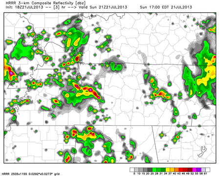
Here is the HRRR model Sunday 4 PM – Monday 1 AM:
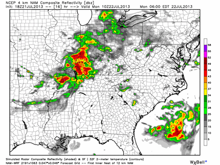
Here’s the Hi-Res NAM model’s take, from Sunday 6 p.m. through Monday 3 a.m.

Monday – Thunderstorms Likely – High 88
7 am 74 . 10 am 82 . 1 pm 86 . 4 pm 88 . 7 pm 85 . 10 pm 79
The below model below suggests a wet, slow morning commute. If I wasn’t a hard working Intern, I’d call in sick.
Hi-Res NAM model Monday 5 AM – 2 PM:
We may clear out a bit during lunch, although it is too soon to say for sure. A few afternoon thunderstorms can’t be ruled out. Rain chances decrease as the day wears on.
Tuesday – Showers/Thunderstorms Possible Severe – High 90
7 am 73 . 10 am 83 . 1 pm 89 . 4 pm 90 . 7 pm 87 . 10 pm 80
Afternoon thunderstorms are expected. Any developing storms could be severe. We say “could be” because a lot has to come together for severe weather, and the weather models are not in agreement.
SPC (Storm Prediction Center) gives us 5% chance of severe weather happening within 25 miles of you.

Rest of the Week
Humidity will be high through Wednesday, but by Thursday, dew points should drop from ~ 71 into the mid to low 60s. That’s still humid, but it’ll feel much better. Next weekend looks like typical July — highs in the upper 80s, with a chance of mostly afternoon showers/storms.
For no good reason:

Categories: Forecast Blogs (Legacy)
You must be logged in to post a comment.