
Storms are expected to develop this afternoon from I-65 east toward Knoxville. They’ll move NNW. This is illustrated by the HRRR, which is predicting what the radar may look like at 4 p.m. today. I put a box around Davidson and Williamson Counties.
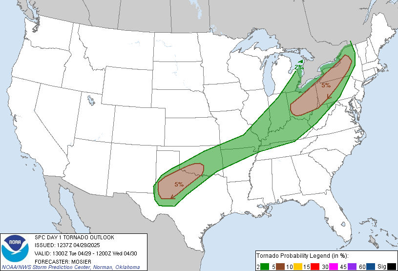
The HRRR does not think we will see anything, but it’s close enough for us to watch. Ordinarily, this would not justify a special morning blog about it; however, the Storm Prediction Center thinks these storms have a very small potential to be severe. There is a:
- 2% probability of a tornado within 25 miles of any point within this area. It’s hard to tell on this map, but the area runs along I-24 south of Nashville, and along I-65 north of Nashville. This means part of Davidson County is included, and it borders Williamson County:
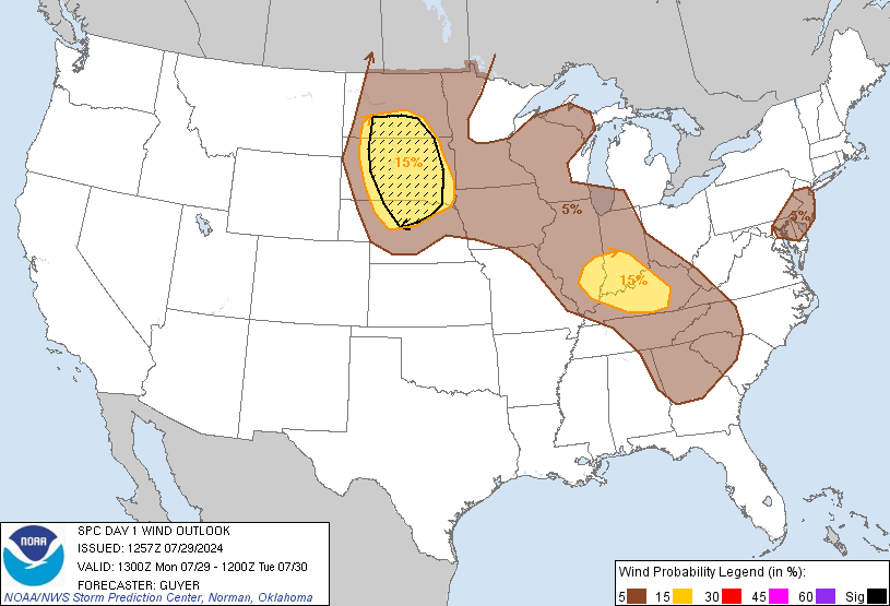
- There is a 5% probability of damaging winds (58+ mph) within 25 miles of you. This includes both counties:
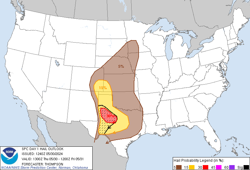
- Finally, there is a 5% probability of hail happening within 25 miles of you today:
SPC will update this throughout today. Again, we do not expect severe weather, but we will be keeping a close eye on it this afternoon.
Additional and more detailed updates can be found on Twitter @NashSevereWx.
Categories: Forecast Blogs (Legacy)