Today – Pop-Up Thunderstorms Possible – High 93
There could be a few random blips of rain in the area today. Most of the action is well to the east, near Cookeville. We may see a few showers try to sneak in from the northwest later on, but the HRRR isn’t a believer on them getting here.
HRRR model Tuesday 3 PM – 7 PM:

Wednesday – Thunderstorms Possible – High 91
7 am 74 . 10 am 84 . 1 pm 89 . 4 pm 91 . 7 pm 88 . 10 pm 81
Some lingering weak showers could be in the area as we begin the day.
A cold front approaching from the northwest in the afternoon/evening should bring thunderstorms, some of which could be strong. We may even see two rounds of storms.
The Hi-Res NAM model predicts a massive complex of storms. Here it is Wednesday 1 PM – Wednesday 10 PM:

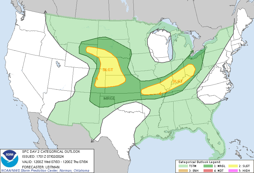
SPC puts us just outside the Slight (think “elevated”) risk area for severe storms tomorrow. There is a 5% probability of severe weather within 25 miles of you. This forecast may change later tonight or tomorrow. The main threat with these storms will be damaging winds and lightning.

Thursday – Cooler, But Still Humid – High 87
7 am 75 . 10 am 82 . 1 pm 86 . 4 pm 87 . 7 pm 83 . 10 pm 75
The cold front may set off more showers in the morning. After it passes, it’ll still be hot and humid, just not as bad as Wednesday.
Categories: Forecast Blogs (Legacy)
