Today – High 90, Maybe a Thunderstorm or Two
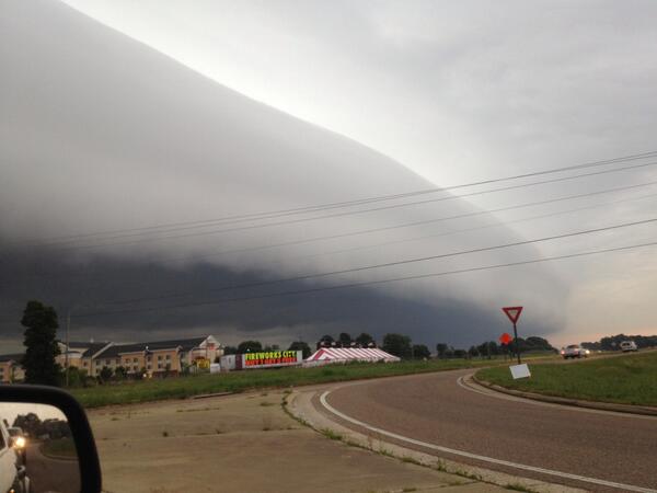
The MCS (Mesoscale Convective System, or large thunderstorm cluster) we were concerned about last night has missed us completely. It arrived this morning in Memphis on its way into Mississippi and Alabama. It produced a cool shelf cloud:
Even though that missed us, we still may see thunderstorms today. Our NWS says a cold front will drop south and stretch across Middle Tennessee this afternoon. This may aid in some afternoon (peak heating) thunderstorm development. A strong (and maybe severe) storm or two is possible, but widespread severe weather is not expected.
The HRRR likes our early afternoon rain/storm chances. Here it is at 1 p.m.:

Expect a high of 90, with a heat index up to 93. This will be our last hot day for a while.
The Weekend & Next Week
Behold the following high temperatures:
Saturday – High 84, Slight Chance of Thunderstorms
Sunday – High 79, Decent Chance of Rain/Thunderstorms
Monday – High 79, Chance of Rain/Thunderstorms
Tuesday – High 82, Chance of Rain/Thunderstorms
Wednesday – High 82, Chance of Rain/Thunderstorms
To get unseasonably cool temps like this in June, it comes at a cost – cloud cover and rain chances. Still, this is awesome.
Categories: Forecast Blogs (Legacy)

