
Today we’ll feel high humidity and temps topping out in the low 90s, but the main concern is the possibility of severe weather this afternoon and tonight.
Before I dive into the weather models, remember: weather models are useful tools for guidance. They are not Gospel. They are often off by hours, or “wrong” altogether.
General Sherman storms (attacking from the North) will start dropping south from the Ohio River Valley this afternoon. We expect two rounds of thunderstorm activity.
First, scattered storms may develop early this afternoon. As the HRRR suggests below (at 3 p.m.), these storms could form a broken line and move east. Expect heavy downpours and frequent lightning wherever storms appear. Strong/Severe storms cannot be ruled out.

Second, the main event, what meteorologists (and those looking to impress / be made fun of at parties) call a mesoscale convective system, or MCS. This is a technical term for a solid group of thunderstorms, moving together.
The RAP (a weather model) at 9 p.m. tonight shows the thunderstorm complex swinging into Kentucky and Middle Tennessee:

The bit-more-hi-def WRF model brings in a “wee hour” event around 2 a.m. Thursday morning:

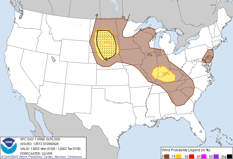
What kind of storms are we talking about? Mainly damaging winds at or exceeding 58 mph. The Storm Prediction Center’s 8 a.m. outlook says there is a 15% probability of a damaging wind event happening within 25 miles of you today (at 2 a.m., SPC has us at 30%):
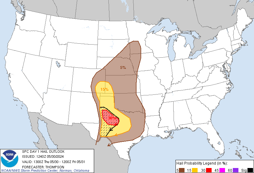
The probability of large hail (1″+) occurring within 25 miles of you today is 15%:
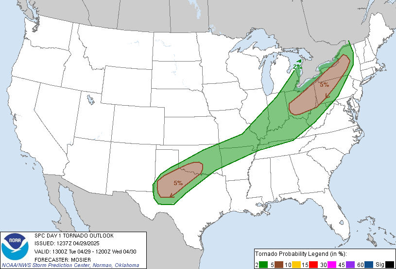
Finally, the tornado risk cannot be ruled out. There’s a 2% chance a tornado will happen within 25 miles of you today:
SPC will update these outlooks around lunch today. We will provide additional information and during-the-storm coverage on Twitter @NashSevereWx. Be sure to find a wake-me-up app or weather radio, and consult all reliable severe weather sources (not just us!) throughout the day.
Categories: Forecast Blogs (Legacy)