
Today
Storms are firing up to our west and along I-65. They’re moving NNE instead of the typical W to E motion. A few maybe strong, some severe.
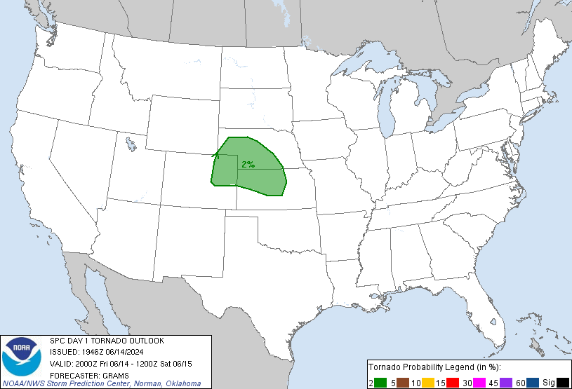
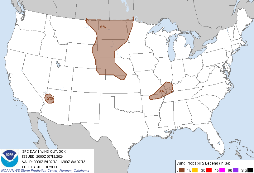
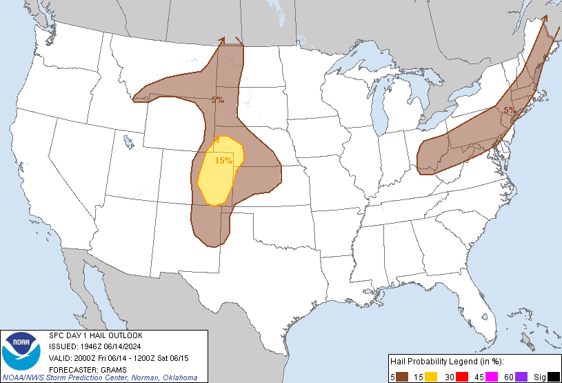
The Storm Prediction Center issued its mid-afternoon update. Our severe risks have been downgraded.
Probability of a Tornado within 25 miles of you: Still 2%:
Probability of Damaging Winds (58+ mph) within 25 miles of you: Downgraded from 15% to 5%:
Probability of Large Hail (1″+) within 25 miles of you: Downgraded from 15% to 5%:
Expect off and on showers to continue until they weaken after dark.
The better severe chances remain off to our east. For us, this threat is marginal, but you should still keep an eye on it. Find real time during-the-storm information on Twitter @NashSevereWx.
If you read this morning’s forecast, you can stop reading. If not, keep going!
Thursday – High of 78
Our NWS forecasts a chance of rain for NE Middle TN and the plateau. We might see a shower or two, but we don’t expect more than 0.10″ of rain.
Memorial Day Weekend
Highs: Friday – 70, Saturday – 78, Sunday – 82, Monday – 84.
This morning, the NWS wrote that the two main medium range weather models disagree about our weekeend rain chances. One model puts a warm front north of us, which keeps us warm and dry. The other places the warm front between W TN and N AL, would keep “showers and storms in the mid state just about each day through the Memorial Day Weekend.”
So, which one is right? No one knows for sure. The NWS forecaster who wrote the morning discussion (Boyd) is a NWS legend. He has been forecasting since before any of us could read (we’re all under 35 here, right?). He likes the first model (warm and dry), and has put our rain chances anywhere between 0% and 10%.
Categories: Forecast Blogs (Legacy)