
The models keep things pretty quiet today through tomorrow morning. Here is the RAP model from Thursday night through Friday morning at 10am:

Friday – 63/78
The weather models (Euro, GFS, NAM and WRF) deliver scattered rain showers in and around us most of the day Friday and into Saturday morning, all thanks to a “shortwave trough” (low pressure) that’ll truck on through.
Rain is likely most of Friday. Up to 1″ should fall by Saturday morning.
Saturday – 65/82
Once the shortwave passes Saturday morning, the chance of rain will decrease, but there will still be potential for additional rainfall.
Some of our best friends (they’re married) are having an anniversary party Saturday night. Their smartphone’s crap-app says there is a “60%” chance of rain Saturday, which isn’t very helpful. We think it’ll rain Saturday morning, then the rain should move off to our east before/around noon.
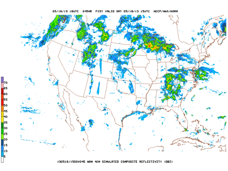
The below Hi-Res NAM animation for Saturday (10am-1pm-4pm-7pm-10pm) shows a Saturday afternoon clearing out. If it’s right, all will be well. (That said, never trust one model completely. You should not alter any outdoor plans, but be prepared to deal with some rain, and maybe a thunderstorm or two Saturday afternoon).
Sunday – 66/87
Still have a chance of rain, but Friday and Saturday look much wetter.
Categories: Forecast Blogs (Legacy)