
Tonight the Storm Prediction Center removed all of Davidson County and some of Williamson County from its Slight Risk (of severe weather) outlook. Only south Williamson County is hanging on:

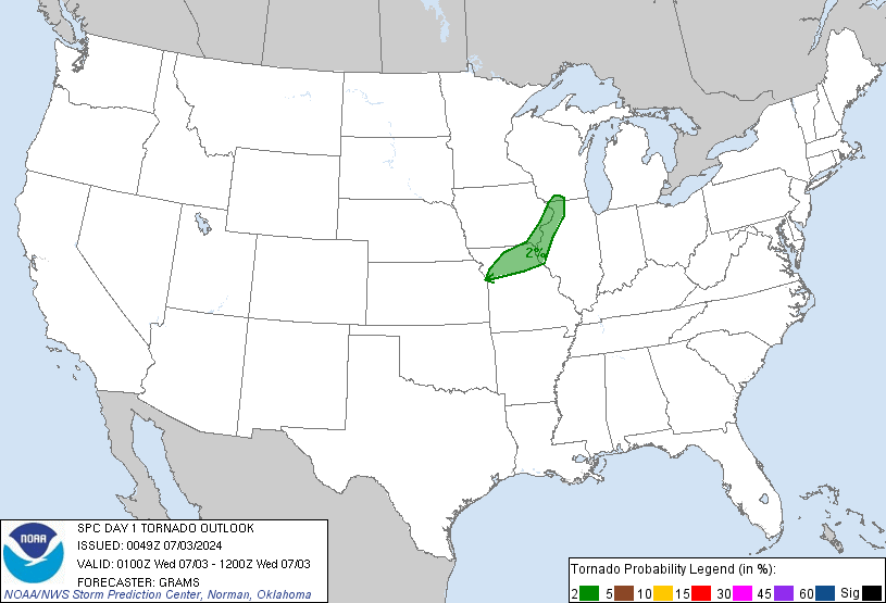
Tornado
There’s only a fringe chance of a tornado tonight: a 2% probability of a tornado happening within 25 miles of those in Williamson County:
That said, at 8:38pm, a Tornado Warning was issued in southwest Kentucky. So, there’s reason to watch what’s going on:

However, the Storm Prediction Center insists the remaining tornado concern is well to our south:

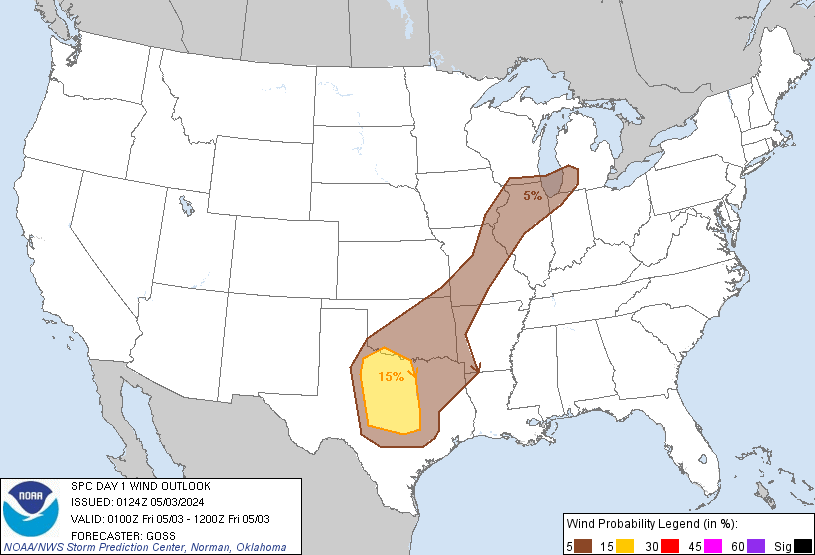
Damaging Winds > 58 mph
The probability of damaging winds remain the most likely threat, and even it has been downgraded between 5% and 15%:
Hail
The SPC says there’s no quantifiable probability of hail > 1″:

Even in Mississippi, the probability of hail is small.
Tomorrow & The Weekend
Temps will crash. We aren’t forecast to make it out of the 50s tomorrow. You’ll need a jacket tomorrow.
The weekend looks sunny and cool. We may even see frost Saturday morning. Highs will be 64 Saturday, 67 Sunday.
Categories: Forecast Blogs (Legacy)
You must be logged in to post a comment.