
Noon weather balloon data from Nashville and surrounding NWS offices showed a real, but lessening, severe weather threat for tonight.
The squall line nearing the Mississippi River continues to underwhelm – very few warnings on the line at all, and none (as of this writing ~ 3pm) on the segment of the line heading into Tennessee.
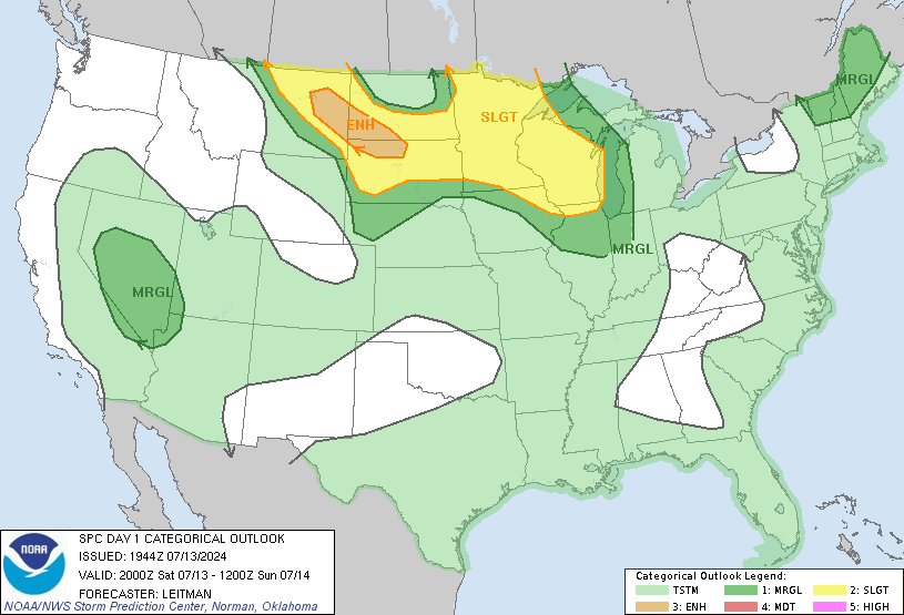
Overall Risk
This morning we were on the line between Slight and the more dangerous Moderate Risk area. Right now, the Moderate Risk has been taken down:
Tornado
The “hatched” (shaded) area has been moved further west and away from us. A hatched area means there is a 10% probability of an EF 2 or stronger tornado happening within 25 miles of anyone inside the point. Our risk is not-hatched and sits at 5%. It’s worth paying attention to, but it’s a move in the right direction.

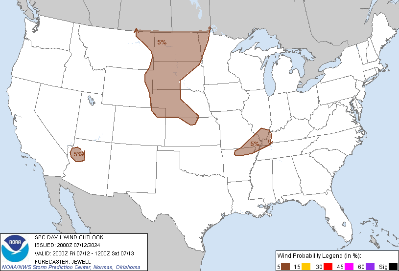
Damaging Winds > 58 mph
This morning we were put right along the 30% to 45% line for probability of damaging winds. Now we are inside the 15% probability area:
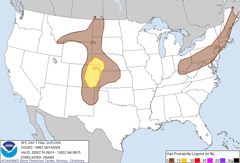
Hail
Completely removed. I would not take my car out of shelter, but I also wouldn’t park my car next to a gas station pump all night if unable to park it under a garage, carport, moving helicopter blades, etc.
A squall line is coming, and there may still be severe weather tonight, but there is much more cause for optimism these storms will weaken upon arrival sometime after 11pm tonight.
Follow @NashSevereWx on Twitter for more detailed and updated information.
Categories: Forecast Blogs (Legacy)