Glorious Weekend
Our NWS issued a Frost Advisory, effective Saturday morning from 4am to 8am. Here’s why:
WITH NEARLY FULL RADIATIONAL COOLING SETTING UP, TEMPERATURES WILL SLIP
BELOW 40 DEGREES MOST AREAS, WITH FROST DEVELOPING BY MORNING. WITH
TEMPERATURES DROPPING DOWN TO 33-37 DEGREES IN OUTLYING AREAS WEST
OF THE PLATEAU, HAVE ISSUED A FROST ADVISORY FOR THE 09Z-13Z [4AM-8AM]
PERIOD.
Temps will warm rapidly, topping out at 67 Saturday and 74 Sunday. It’ll be another awesome weather weekend.
Next Week
A SERIES OF WEAK SHORTWAVES WILL AFFECT MIDDLE TENNESSEE FROM SUNDAY
THROUGH THE END OF THE 7-DAY FORECAST PERIOD, WITH AN INCREASED
CHANCE OF CONVECTION THURSDAY AND THURSDAY NIGHT WITH THE NEXT FRONTAL
PASSAGE.
Translation: there’s a chance of rain and thunderstorms (“convection”) every day next week (from the shortwaves).
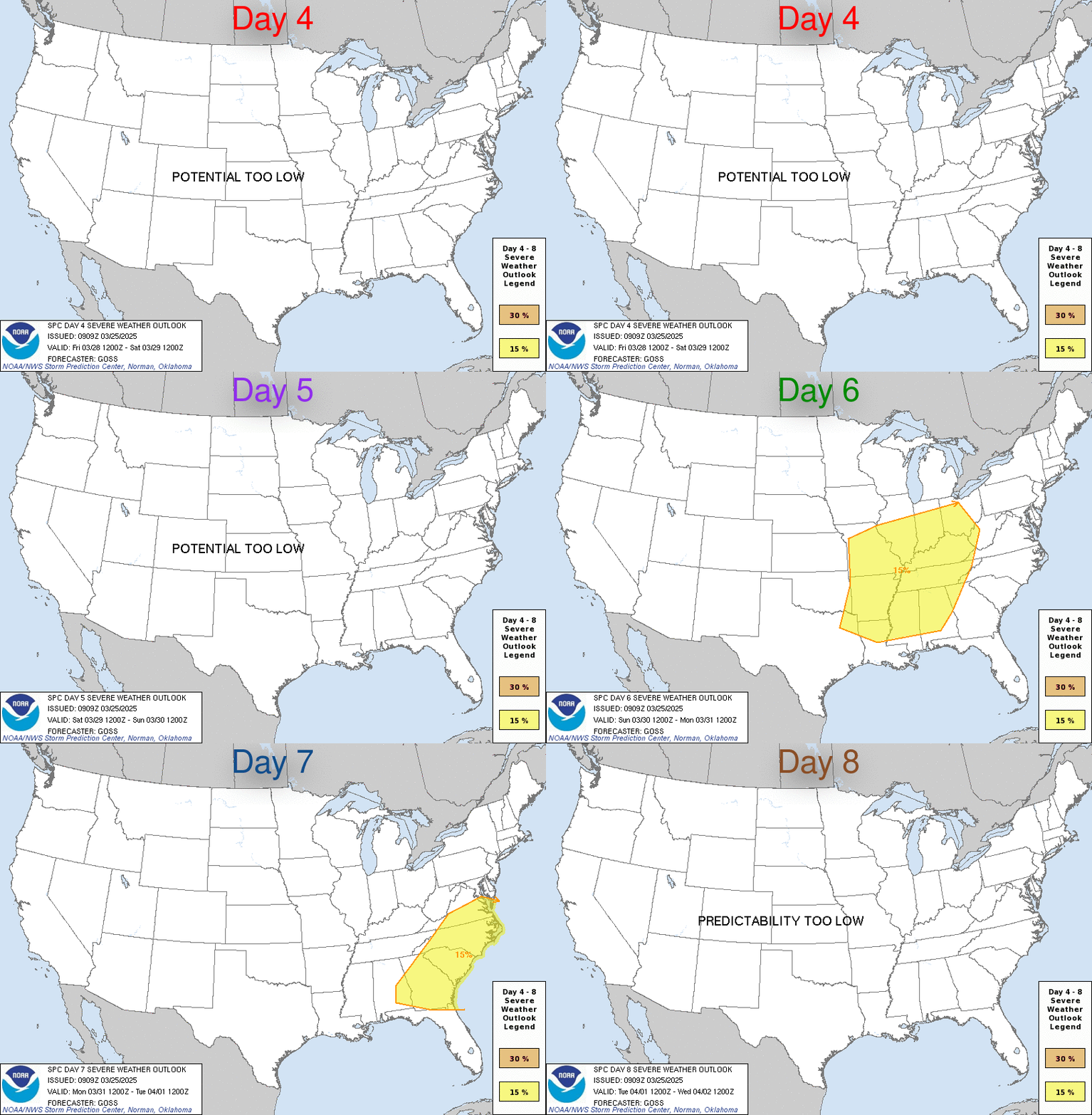
According to the Storm Prediction Center, Thursday brings our best chance of storms:

Day 6 (above, in green) is Wednesday. That system will move east in our general direction, which would put a rough ETA of Thursday for us, which would make three consecutive wet Thursdays.
NOAA thinks that system will be packing 2″+ of rain:

But, that’s really far away. Enjoy the weekend!
Categories: Forecast Blogs (Legacy)
