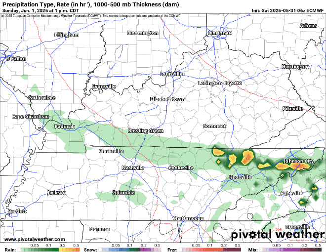
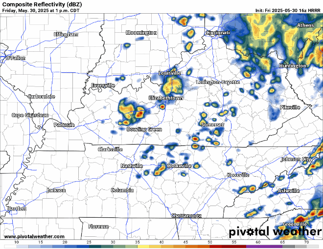
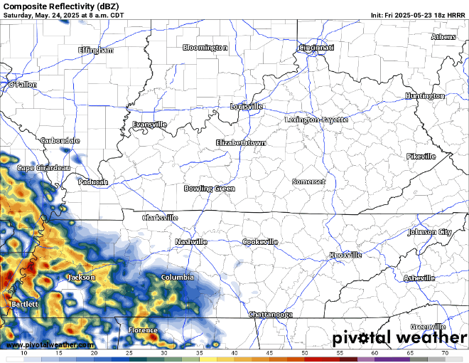
Dry + Hot Forecast Ahead

Fairly quiet forecast upon us.

Although still very warm, rain chances still be almost non-existent. Very low (10% and less) rain chances will be around Wednesday and Friday, but otherwise – nada. read more

Where Are U Fall?

No hazardous weather expected in the next 7 days – besides it being hot I suppose, but nothing crazy considering we are in early August.

High temperatures will slowly relax, getting down to the upper 80s by the weekend. read more

Quiet + Hot Stretch of Weather

Still no meaningful rain chances to talk about for at least the next 5 days. Enjoy the dry weather!

Although temperatures thru Wednesday will be in the mid to upper 90s. Heat index values could creep up to around 100 degrees, but not nearly as bad as last week. Continue to take it easy if you have to be outside for long periods of time. read more

No Rain, No Storms, No Problems

PSA:

Rain chances today will be confined to the Plateau, leaving us dry. Concert-goers, fair-goers, any outdoor plan-goers, all good to go.

Although it’ll still be hot, it’s still summertime after all. Dewpoints will be in the upper 60s this week, making the heat a bit more manageable. read more

Drier Weather Pattern Begins Saturday

The hot weather isn’t going anywhere. High temps in the 90s for at least the next 6 days. Heat index values will continue to be around 100° during this time.

We have one more day of Wattery chances before a pattern shift gives us several days of dry weather. read more

Heat Advisory Thursday, Wattery Chances Hanging Around

The heat continues.

A Heat Advisory will be in effect until 7pm Thursday.

Heat index values up to 110° will be possible.

Temperatures in the upper 90s paired with dewpoints in the low to mid 70s will make already-bad upper 90s feel even worse. If outdoors, take frequent breaks in the shade, drink plenty of water and check in on friends + family who may not have air conditioning. read more

Heat Advisory Today + Wednesday, Low-End Severe Storm Threat

Lots to talk about.

First – hot.

Heat Advisory will be in effect today and Wednesday from noon to 7pm.

Heat index values up to 110° possible both days.

If outdoors for long periods of time, take frequent breaks and stay hydrated. Look before you lock – never leave children or pets in a parked car. read more

Heat Advisory Tuesday, Low-End Chance for Damaging Straight-Line Winds Today + Tuesday

Both our counties will be under a Heat Advisory from noon to 7pm on Tuesday.

Heat index values up to 109° will be possible.

Take precautions if outdoors – take frequent breaks, drink plenty of water, wear light clothing… read more

Heavy Rain Sunday + Monday - Localized Flooding Possible, Brutal Heat OTW

Infographic for flooding - turn around, don't drown.

Although more isolated than yesterday, a few folks will draw winning Wattery tickets this afternoon and evening. Brief heavy rain + lightning possible.

Much higher rain chances exist Sunday + Monday.

18z HRRR model (above) shows chances for showers/storms getting going early Sunday morning, continuing throughout the day. Any storm could contain lightning, heavy rain + gusty winds. read more

More and More Wattery Chances, Localized Flooding Possible

Can’t seem to shake the daily Wattery chances – we can blame the moist, soupy airmass for that.

Each day thru the middle of next week will have:

  • chances for showers/storms – mostly in the afternoon + evening
  • no one knows exactly when/where they may pop-up
  • lightning and heavy rain possible with any storm
  • localized minor flooding possible with some of the heavier rain – watch out for ponding on roadways
  • no severe weather concerns, but maybe some gusty winds in some storms

Lower rain chances Saturday, higher chances Sunday + Monday – but chances exist every day. read more