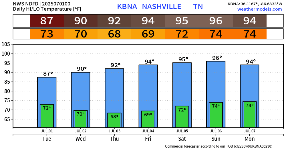
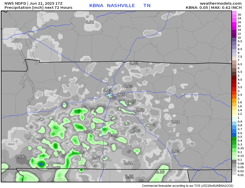
Tuesday looks to be our last day with Wattery chances for a while.
Chances will pick up late morning and continue thru the evening. Most of the activity looks to be focused E of 65, similar to today – but still, anyone could see a shower or storm.

Tuesday looks to be our last day with Wattery chances for a while.
Chances will pick up late morning and continue thru the evening. Most of the activity looks to be focused E of 65, similar to today – but still, anyone could see a shower or storm.
We continue our unsettled pattern thru Tuesday.
I know I sound like a broken record, but scattered showers and storms will be possible daily, mostly confined to the afternoon and evening. Some will see some heavy rain, while others see none.
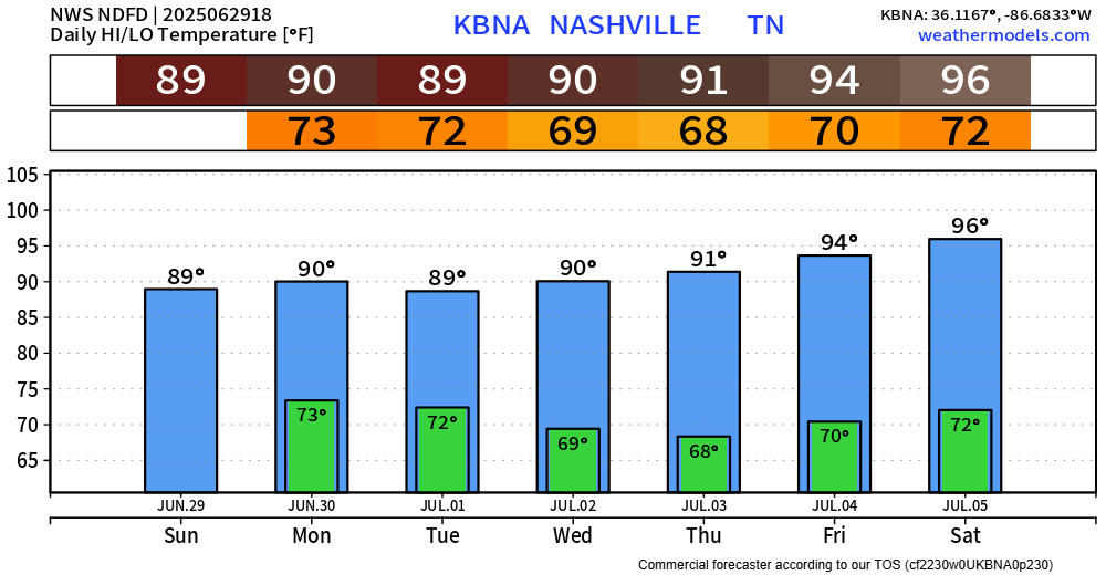
Our 12z morning sounding from BNA today looks fairly similar to yesterday’s. No coincidence – much of the same can be expected. Our atmosphere will look fairly similar each day thru Tuesday.

We have one more day of our Heat Advisory, which expires at 7p today. Once again, heat index values up to 105° will be possible this afternoon and evening.
Although it will still be hot this weekend and next week, it just won’t be as hot. It’s still summer, so continue to take it easy if you must be outside for long periods of time. High temperatures continue to be in the low 90s.
Outflow boundary that moved thru this morning did a couple of things for us.
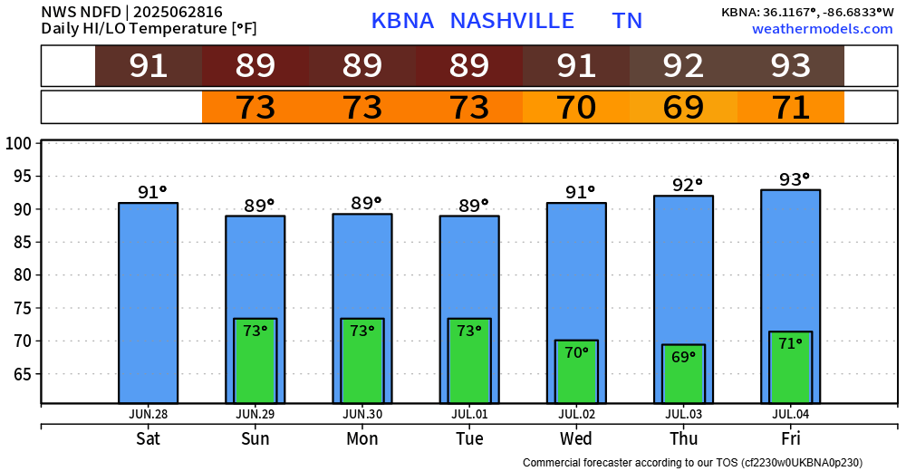
The Heat Advisory continues thru 7p Friday. Heat index values could still reach up to 107° today and Friday.
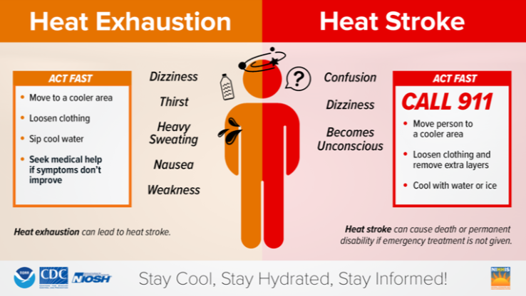
Continue to take it easy if you must be outside for long periods of time. Stay hydrated, take frequent breaks, and look before you lock.
Unfortunately, I could copy and paste the blog from yesterday for today. I won’t – but the heat remains brutal.
Today and Thursday will likely be the hottest days of the week.
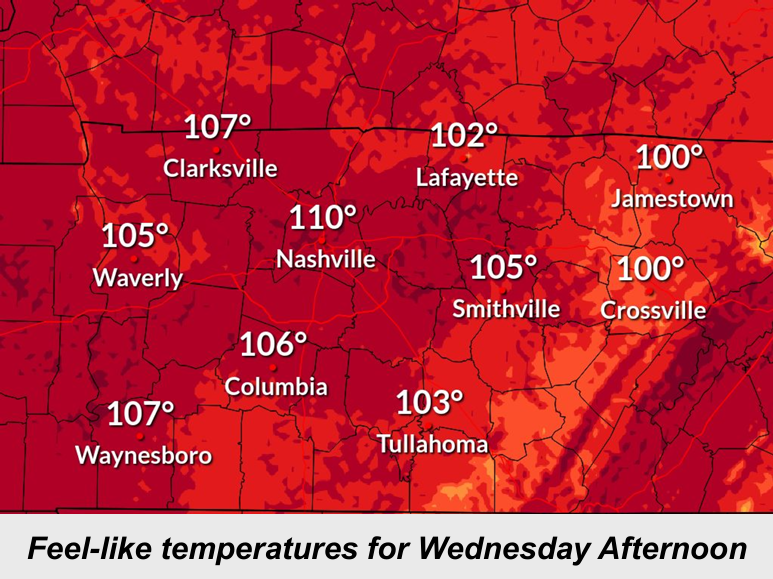
Heat index values (aka “feels like” temps) will again peak near 110° this afternoon.
At 9a, BNA reported a temperature of 88°. It could be worse, at the same time, Logan International Airport in Boston was reporting 93° as they make their way up to 102°.
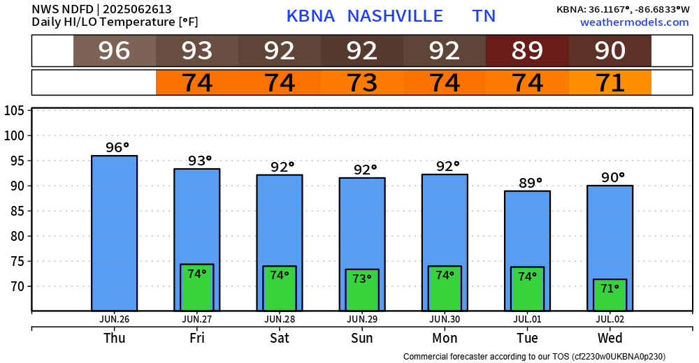
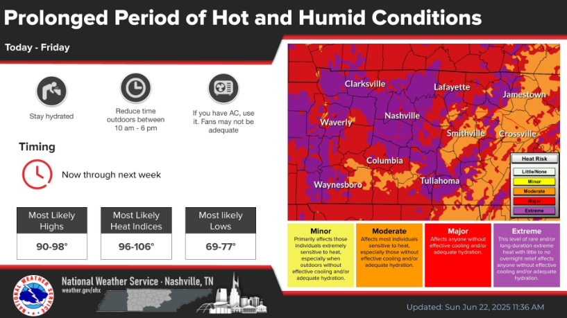
Our brutal heat will continue today – as well as through the end of the week. We are still under a Heat Advisory until 7p Friday.
As suspected, NWS Nashville has gone ahead and extended our Heat Advisory until 7p Friday.
Why? Heat index values will reach up to 107° daily.

Take precautions if you have to be outdoors for prolonged periods of time.
Showers and storms have helped cooled things off – which has been welcomed, prior to storms heat index values were in the low 100s.
Heat index values will continue to be in the 100 – 106° range thru this weekend.
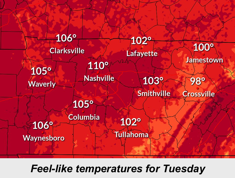
As of 2p, the heat index at BNA was 103°.

This will be common each afternoon over at least the next 6 days.
High temps will easily reach the mid 90s, even upper 90s by the middle of next week.
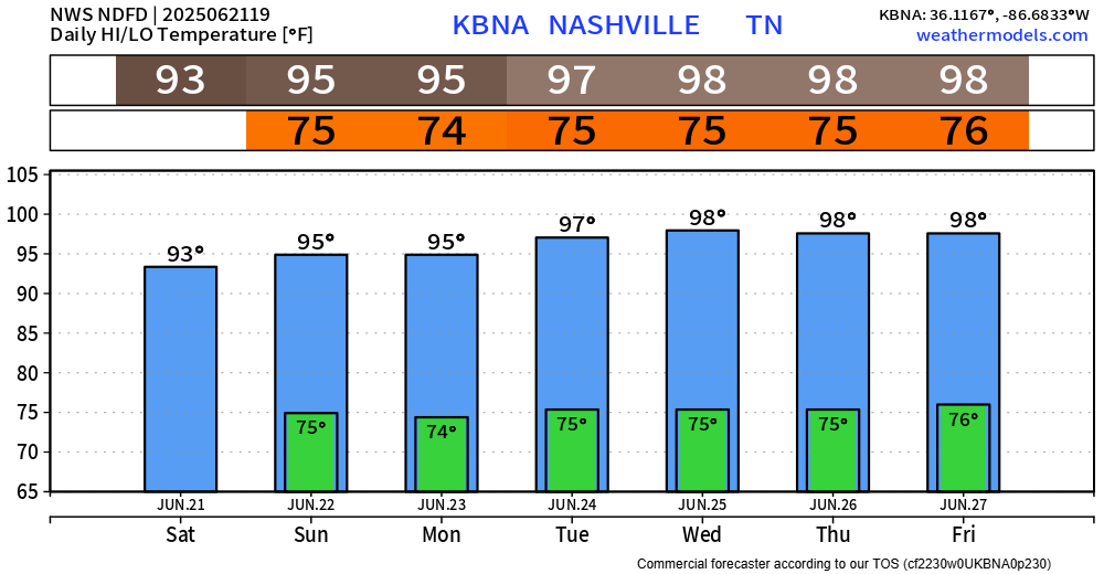
Dewpoints in the ‘I need gills to breathe’ range will keep heat index values near 105° daily.
You must be logged in to post a comment.