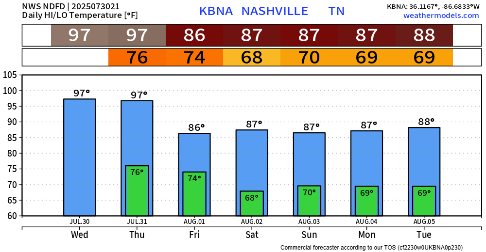
Another scorcher today, BNA peaked at 98°.

Although it remains unlikely, a few folks could see a shower or storm this evening – but think majority of us stay dry.
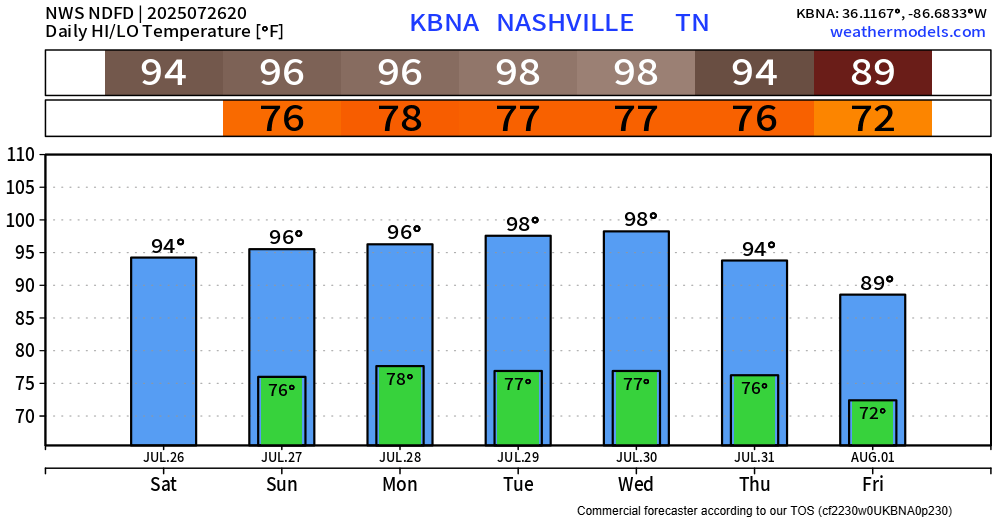
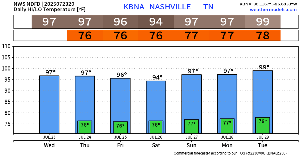
We have just one more Heat Advisory to get thru this week, valid Thursday until 8p.

Another scorcher today, BNA peaked at 98°.
Although it remains unlikely, a few folks could see a shower or storm this evening – but think majority of us stay dry.
We have just one more Heat Advisory to get thru this week, valid Thursday until 8p.
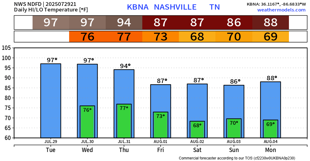
We continue to have an Extreme Heat Warning until 8p Wednesday.
Heat index values up to 113° will be possible during the afternoon and evening.
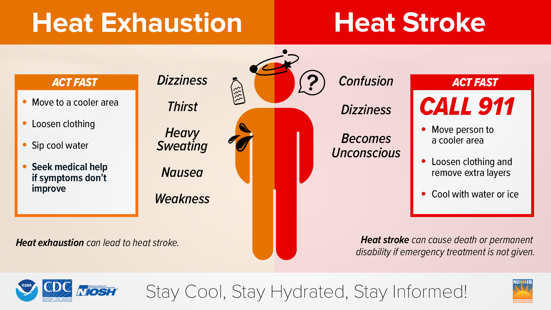
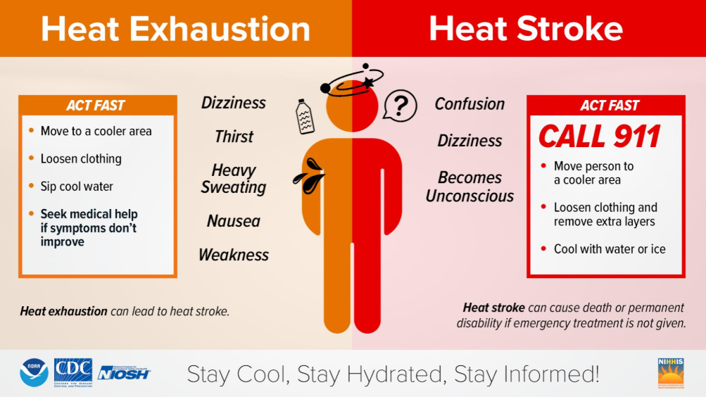
Heat illness can occur quickly with conditions as hot as this. Please, take it easy if you have to be outdoors for a long stretch. Take frequent breaks, stay hydrated, and watch out for others.
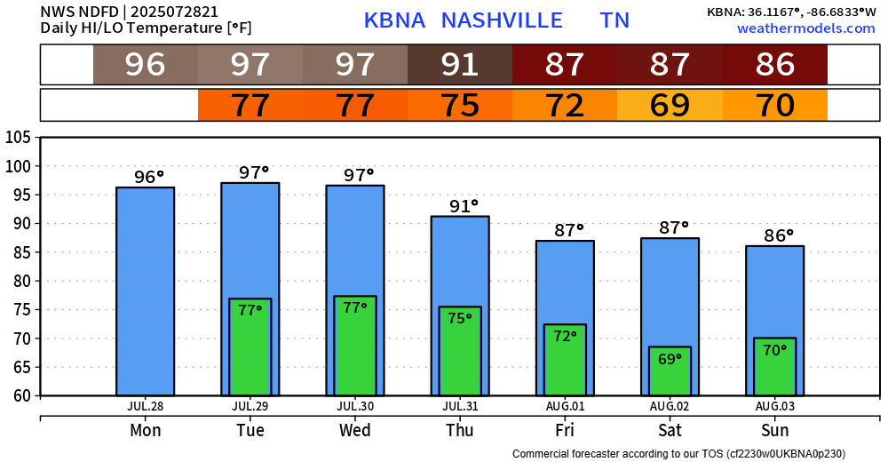
Today was our 27th consecutive day of 90°+. Tied for the 6th longest such streak on record.
We are likely to see 28, 29, and possibly 30 [consecutive days] by Thursday. For those curious, the record is 34 consecutive days, set in 2007 per NWS Nashville – thankfully we won’t see that.
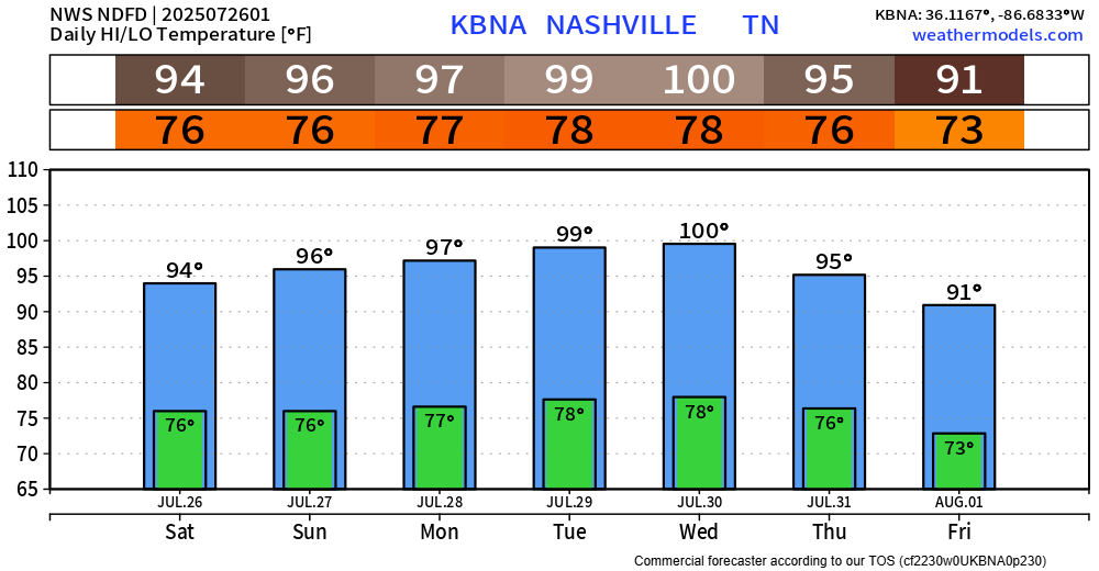
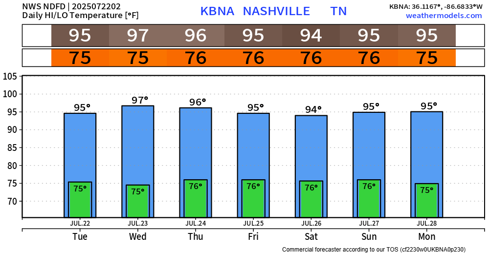
Our Heat Advisory started this morning and will continue thru 8p Wednesday.
Heat index values will peak in the 105-110° range each afternoon and evening.
For those that must be outdoors for long periods of time, please take it easy. Take frequent breaks, stay hydrated, and watch out for signs of heat illness.
It’s still hot today, but just not hot enough to get us into Heat Advisory criteria.
Sunday thru Wednesday – we’ll have no problem getting there.
Heat index values in the 105-110° range will be likely.
Although it’ll still be hot on Saturday, we won’t have a Heat Advisory for the first time since Sunday. Heat index values will still be near 100°, but most of us should stay below the Heat Advisory criteria of 105°+.
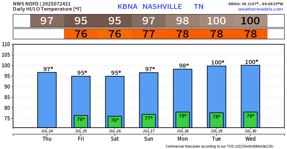
Another day, another Heat Advisory in effect until Friday 8p.
Heat index values will yet again be up around 105°.
High temps will drop only a couple of degrees this weekend, but this may be just enough to break our streak of Heat Advisories.
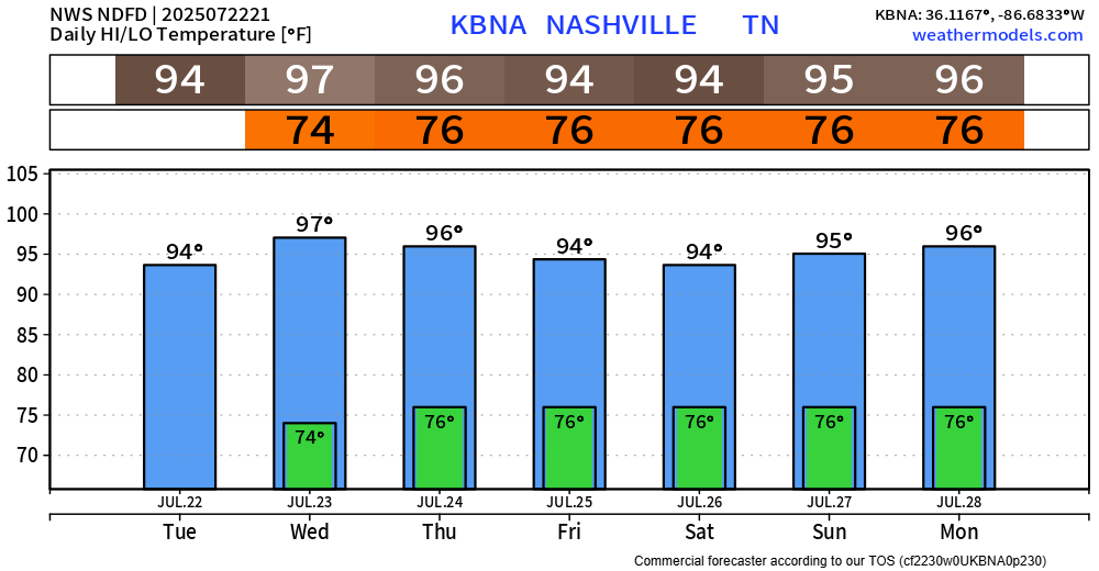
Our Heat Advisory has continued to get extended and is now valid until 8p Thursday.
Heat index values will continue to peak near 108° each afternoon and evening.
And it looks like this brutal temp + dewpoint combo will be a common theme for us thru the end of July.
High-res models continue to show signs for a dry Coldplay concert tonight. It’ll still be hot out but think we make it without any “Sparks” – fingers crossed.
If there are any updates – we’ll post them to all of our socials.
Some dense fog is possible tonight and early Tuesday morning. If you encounter any on your AM commute, take it slow.
Main story for this week is still the heat.
We still have a Heat Advisory in effect until 8p Wednesday.