
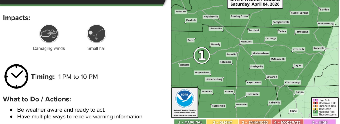
Not much has changed regarding the forecast for our showers/storms expected to move in later this afternoon and evening.
The only real change is that the Storm Prediction Center has introduced a 5% chance of damaging straight-line winds within 25 miles. No tornado concerns today.
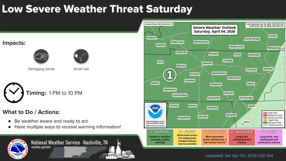
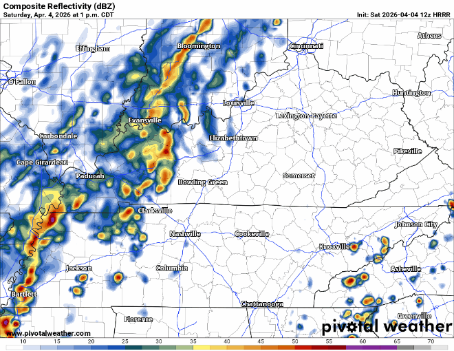
Timing is still generally on track. The broken line of showers/storms should arrive sometime between 3 and 6p. I’d lean on the earlier side of that range.
The latest HRRR model gives it a guess:
We’ll be posting updates as needed on all of our socials.
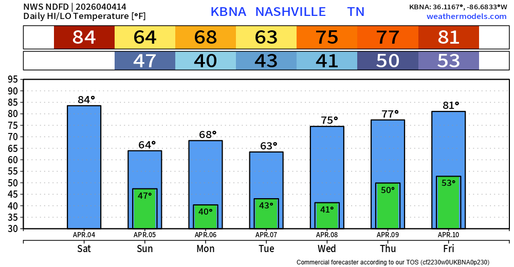
Still feel good about the rain ending prior to sunrise tomorrow, so any Easter plans you may have look dry with highs in the low to mid 60s.

The cold front will bring us some beneficial rain, along with cooling temperatures down. We’ll have some around average temperatures for a few days before we warm right back up into the 80s. No additional rain chances in the forecast.
Categories: Featured Blog