

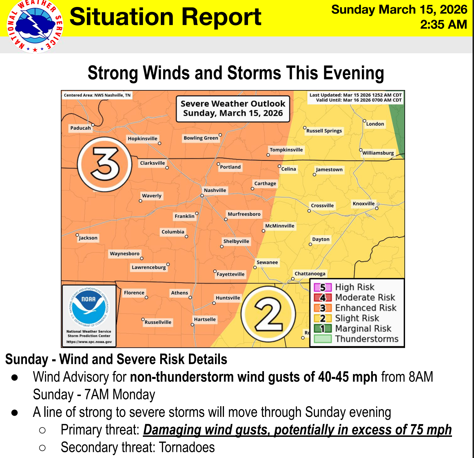
A strong storm system moving across the Plains today will push a cold front through middle Tennessee tonight, bringing the risk of severe weather to Davidson and Williamson counties. The Storm Prediction Center has placed much of the area in an Enhanced Risk, which means scattered severe storms are expected and a few could be intense. The main story tonight is damaging winds and a secondary risk for tornadoes. We’re watching for CAPE to build as the line approaches which could make storms more intense. We’re also watching for dry air near the surface to pull stonger elevated winds down to the surface. Today is a day to stay weather aware and make sure your family has a plan to shelter in the even of a tornado warning. Let’s dive into the details.
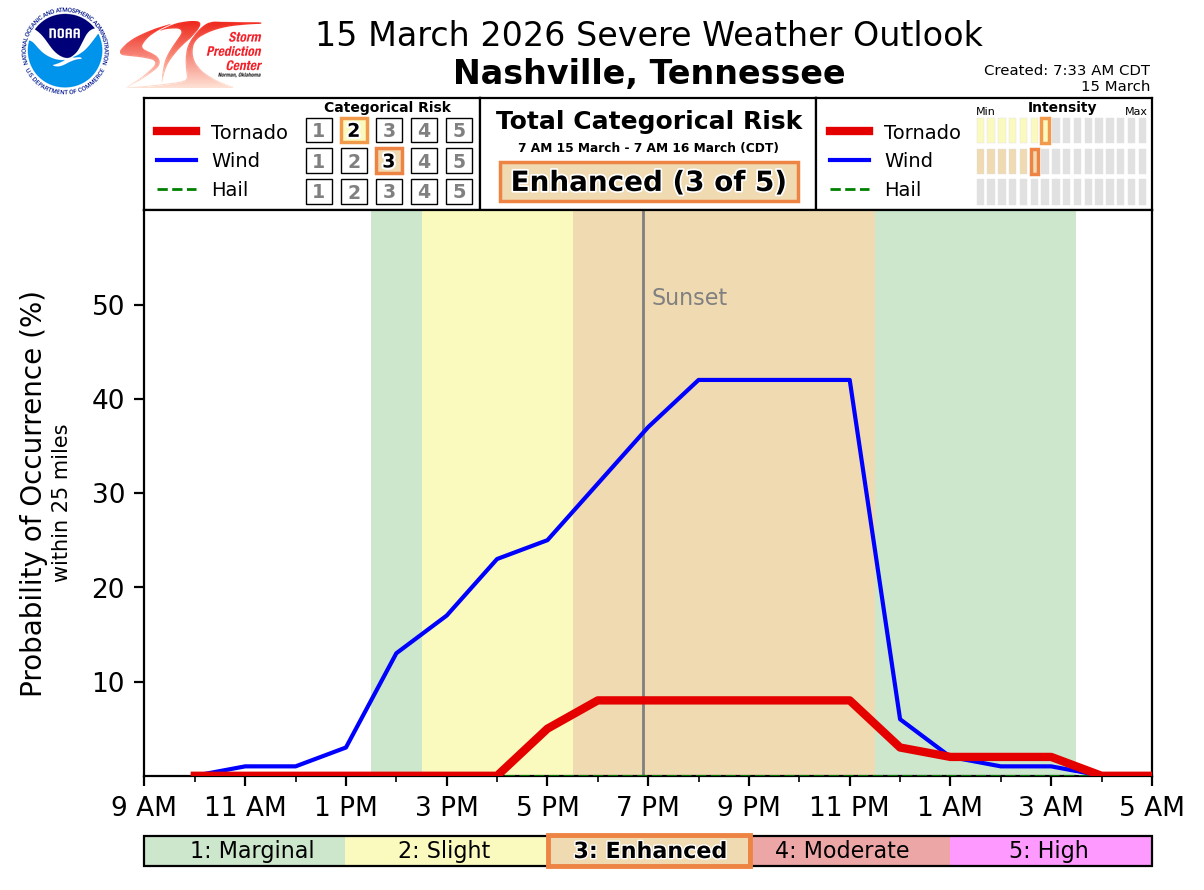
Before storms even arrive, it’s going to be windy across the Nashville area. Strong southerlies ahead of the approaching system will increase through the day, with gusts around 40–45 mph possible outside of storms. These early winds will be non-severe, but they’ll be strong enough to blow around trash cans, patio furniture, and small relatives.
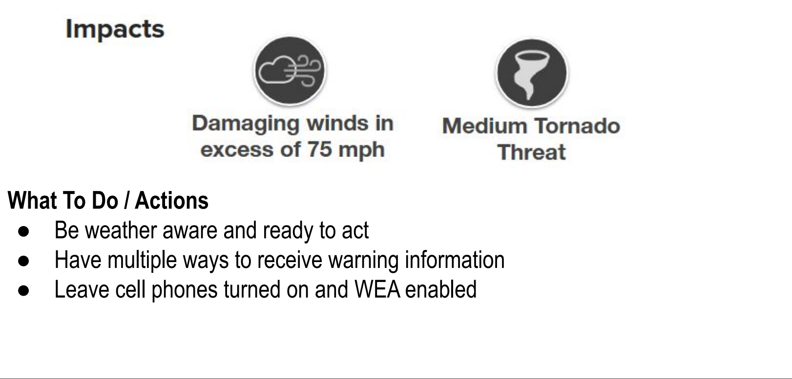
The main severe weather threat arrives this evening in the form of a squall line along an advancing cold front. These systems are known for producing strong straight-line winds, heavy rain, lightning, and sometimes tornadoes as they sweep across large areas quickly. In tonight’s setup, the storms will be tapping into very strong winds just above the surface, which means some gusts could exceed 75 mph in some bowed segments of the line.
Timing… Right now, storms are expected to reach western Tennessee around sunset and then push east across middle Tennessee during the late evening. For the Nashville area, the most likely window looks to be roughly 9 – 11 PM, with storms moving quickly once they arrive.

Have some sort of ‘wake me up’ app and a NOAA Weather Radio ready to go. Our threat could last well past bedtime.
Hazards… While wind is the main concern, tornadoes are also possible, especially along the leading edge of the line. These would most likely be quick spin-ups embedded within the storms rather than long-track tornadoes. The atmosphere tonight has plenty of wind shear, which can help storms rotate. We’re watching for instability and whether enough will be present to turn a rotating storm into a tornado. Any tornado that does form will form quickly and sometimes with little warning.
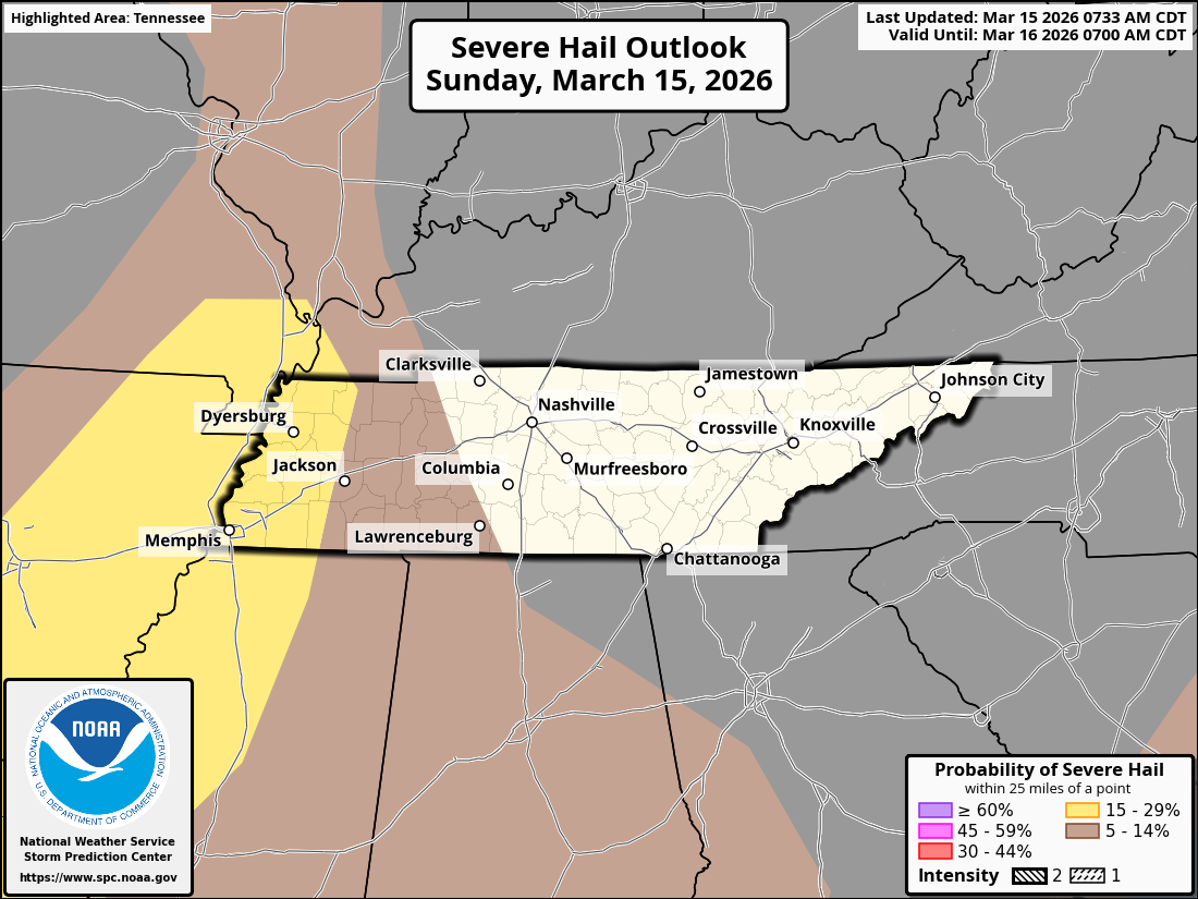
The images below show probabilities for tornadoes, damaging wind, and hail.
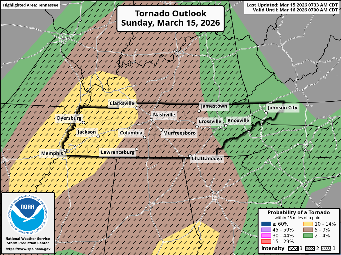
We did get a drop in the tornado probabilities from 10% to 5% from Yesterday. But intensity is still hatched for up to EF2 possible.
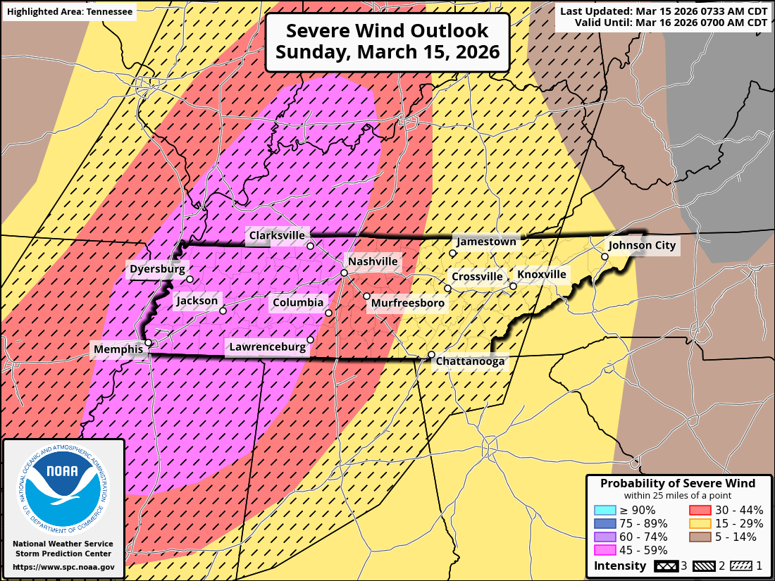
Severe wind threat has increased to 45% with straight line winds in excess of 75mph possible. This is enough to damage buildings and bring down trees. Especially trees already compromised by the ice strom.
We are not outlooked for damaging hail at the moment.
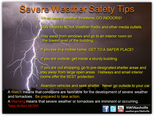
What to do… There are some great tips available on our website. Check out NashSevereWx.com for more.
The rule of the day is Prepared Not Scared! We’ll be on socials all day and will likely update the graphics in the blog this afternoon.
Categories: Featured Blog