
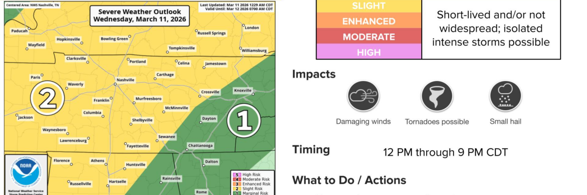
Stay connected. Isolated intense storms are possible today with the chances of seeing these things within 25 miles of you…and associated odds: Tornado (2%), Damaging Straight-Line Wind (15%), Large Hail (5%).
The main severe weather threat (for Davidson/Williamson) comes in the 1-4pm timeframe. There is a potential second round that has a decent shot at never materializing around supper time. The HRRR thinks the atmosphere gets worked over, and never recharges for another round. This seems reasonable.
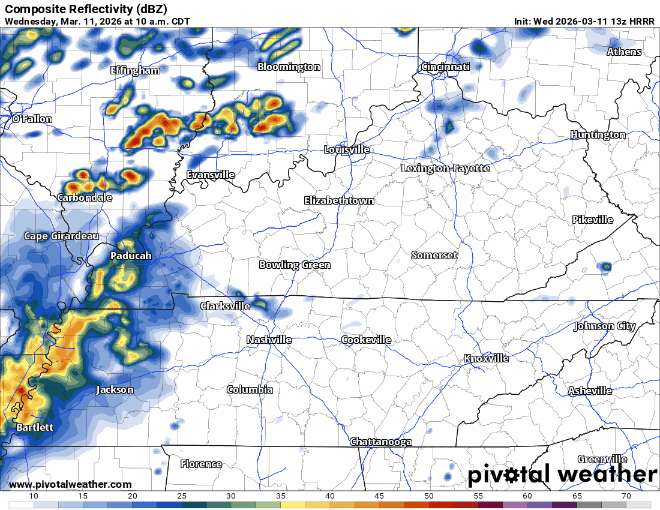
We’ll be watching every radar scan, as usual, as the day progresses and will give updates on our usual socials…and go on YouTube Live if shenanigans get going.
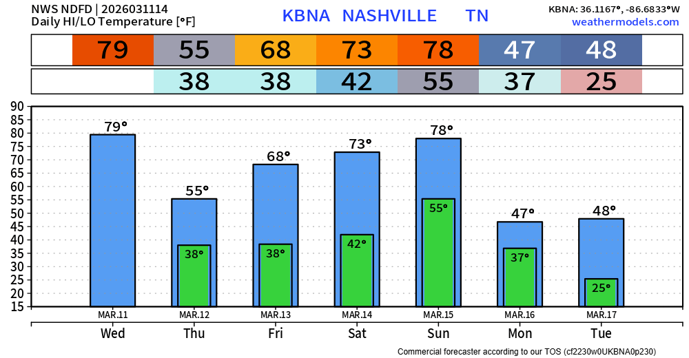
This spicy weather is being caused by a cold front…thus we get a brief cooldown Thursday with highs in the mid-50s and gusty N winds. Back to the 70s on Friday tho.
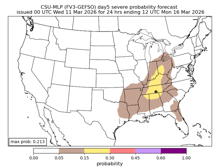
We’ll be watching Sunday-Monday pretty closely over the next few days. Some of the machine learning models take interest in the severe weather chances with our next system. More on this as we get closer. No maps yet from the Storm Prediction Center, but we’ll share if they become available.
Also, you folks that are wanting to plant Spring plants. Hold off. Could get back below freezing early next week. March is a bit early around here.
Categories: Featured Blog