
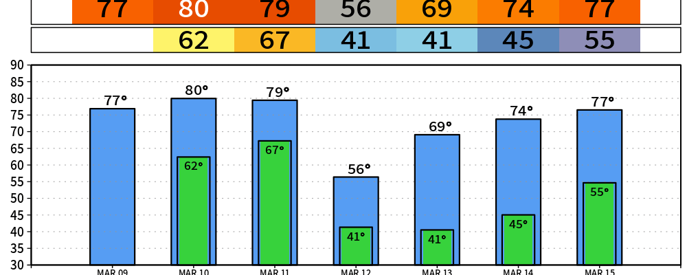
This week, temperatures remain above normal. Very springlike. But springlike also means the risk for rain and storms. Let’s get into it.
Today, our neighbors to the south have a chance for severe weather along the TN-AL border. Storms and rain could drift our way, but no significant impact is expected. A rumble of thunder might be heard in southern Williamson county. Overnight and into Tuesday our chances for rain increase. Still, scattered at best, but some overnight thunder is possible. If that’s the case our morning Dense Fog Advisory could be replaced by a Dense Dog Advisory tonight.

BTW, why does the guy who spends his time on the lookout for thunder have to have a dog that’s afraid of thunder… Topic for another day.
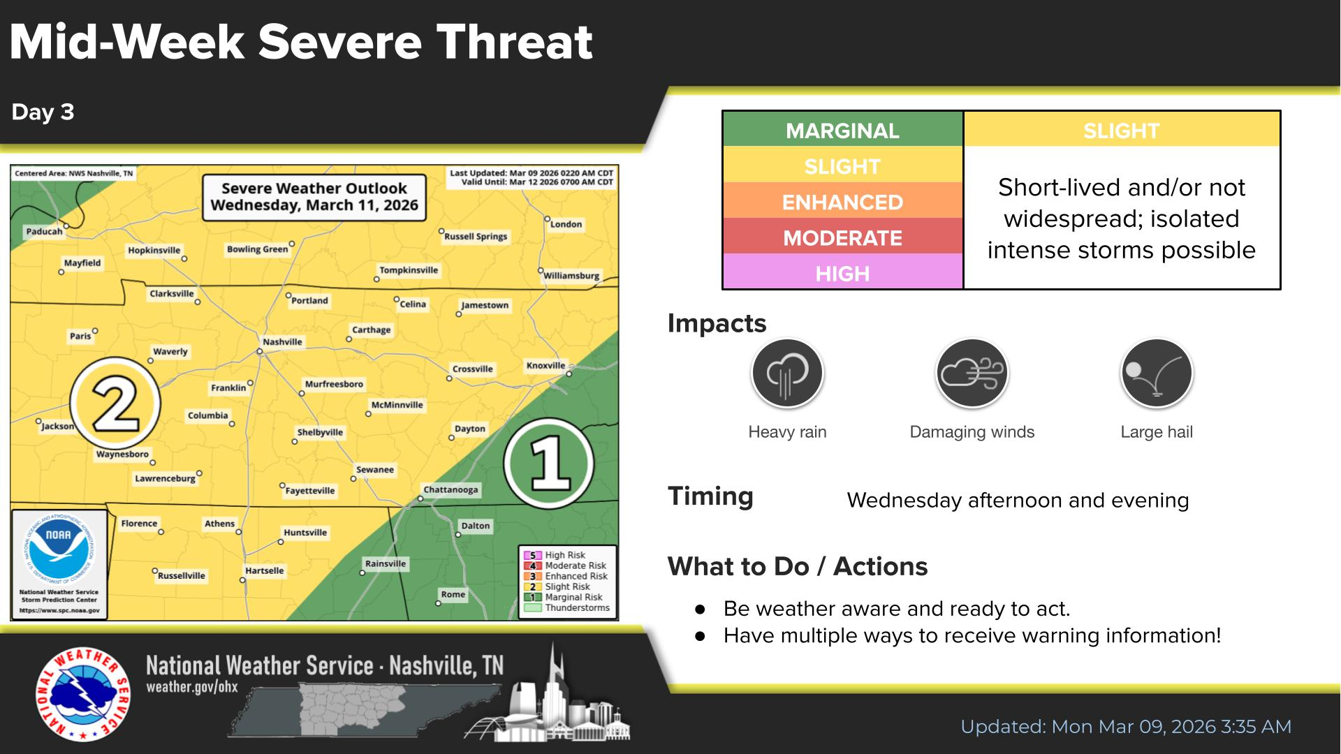
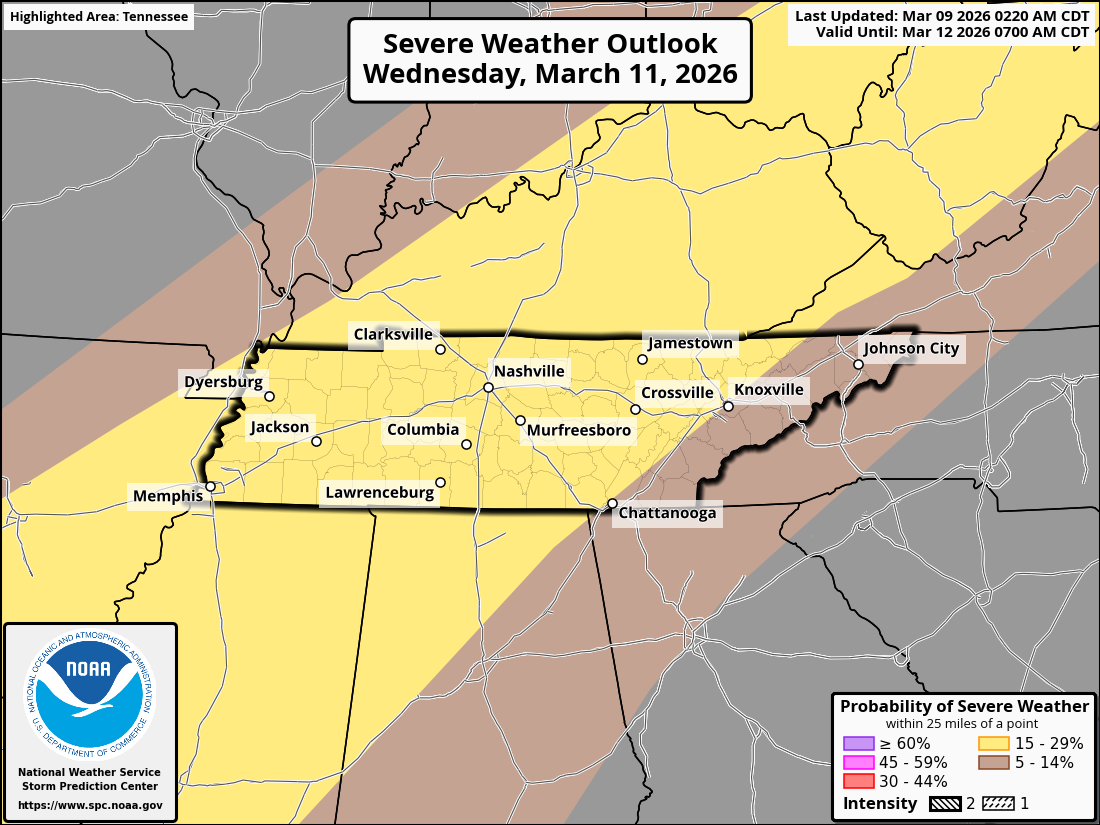
Let’s now turn our attention to Wednesday. NWS Storm Prediction Center has us on the day 3 outlook (above). Right now in terms of probabilities, anyone in our two counties has a 15% likelihood of seeing some kind of severe weather (below). The tornado threat is non-zero but very low right now.
Wednesday appears to be setting up as a linear straight line wind event similar to Saturday. Even if we don’t get severe weather with Wednesday’s strong cold front, we will get a bunch of rain (we need it, just not all at once). There isn’t a big risk for flooding but some ponding on roads will be possible. As always, stay tuned here and on socials for updates as the forecast evolves.
Categories: Featured Blog