
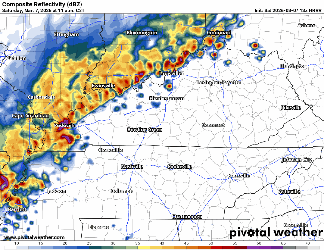
A line of storms is expected to arrive in our two counties in the 1-4 pm range, carrying a risk for damaging straight-line winds and possibly a tornado, although the risks are low. HRRR model from 11 am – 8 pm.
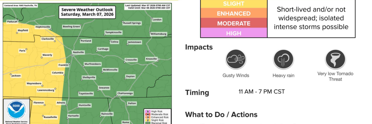
Let’s talk odds. The Storm Prediction Center has tagged us with a 2% of a tornado occurring within 25 miles of us, and a 15% chance of damaging straight-line winds within 25 miles. Bundle all of that together, and you get a graphic like this from our local National Weather Service office. Keep in mind, they forecast for all of Middle TN, so their timings are a bit more broad.

Ingredients
For those who want a bit more of the science, I give you last night’s notes from the forecaster on duty at our NWS.
First of all, the environment is going to be wet; precipitable water comes in at 1.44, which is off-the-charts for this time of year. Look for some high rainfall rates with these storms. Second, the SBCAPE is projected at over 1,100 J/kg with a Lifted Index of -5. So the instability is there for significant convection. Third, the mid-level lapse rate (700-500 mb) comes in at a healthy 6.7C/km, which is unusually high for a sounding that`s this saturated. Thus, sub-severe hail (<1″ diameter) is not out of the question. Fourth, low-level wind shear is going to be modest. The 0-3 km helicity comes in at 145, and this is owing mainly to speed shear, as the wind profile is nearly unidirectional. So it looks like the primary risks are going to be 1). strong to severe straight-line winds resulting from wet microbursts, 2). short-lived intense rainfall rates and 3). small hail.
NWS Nashville, 3/6/26
Translation…parameters look pretty friendly for severe weather. BUT, the shear looks meh. For a large scale tornado threat, we would expect winds at the surface to be more out of the south or even SSE, while winds aloft scream out of the SW. Our winds look to be mostly coming from the SW up and down the profile today. So, lack of directional shear *should* keep the tornado and large hail threats from being higher. But, damaging winds are still in play.
We’ll be updating our usual socials and will jump on a live stream if things get out of hand.
More Severe Weather Mid-Week?
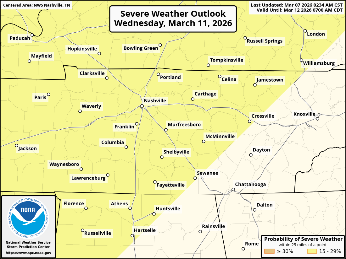
Looking ahead, rain returns for Monday night through Wednesday night. Speaking of Wednesday, we’ll have to keep an eye on severe weather again. The Storm Prediction Center has already tagged us with a 2 out of 5 (15% chance of seeing severe weather occurring within 25 miles) risk for Wednesday. Stay tuned on this one.
Categories: Featured Blog