
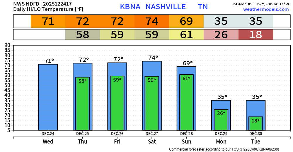
The record high for today is 76° set back in 1964. We won’t get there today (we don’t think), but we are running about 20° above average. Forecast high at BNA is 71°.
For Christmas Day, the record high is also 76°, set only four years ago in 2021. We should make it up to about 72° this year.
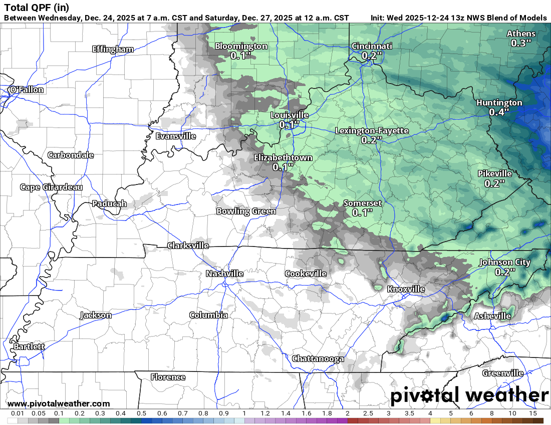
Don’t be shocked if we get some light sprinkles between now and Friday. The best chance for these sprinkles will be on Friday afternoon/evening, but models don’t really agree on that quite yet. All told, precip totals will be very light between now and the weekend.
Our next decent system shows up Sunday, and this will be the end of our warm weather for a while.
Saturday looks to be quite pleasant, but much higher rain chances will develop Sunday and Sunday night as a strong cold front pushes through the region. Indeed, Sunday will be our last warm day for awhile. Temperatures will fall dramatically Sunday night, with a return to winter cold that will persist throughout next week. At this time, it appears that a few locations mainly north of I-40 could see light wintry precipitation Sunday night and early Monday, but adverse impacts are not anticipated.
NWS Nashville
Highs on Monday and Tuesday only appear to be in the mid-30s, and your Christmas shorts go back in the drawer.
Categories: Featured Blog