

Today will be chilly with highs only reaching the mid 40s – which will be nice compared to what we deal with Sunday.
Friday will be the “warm” day out of the next 7, with highs in the upper 50s.
Saturday during the day will be tolerable with highs in the mid to upper 40s. Those planning on going to Dickens of a Christmas, or any other outdoor plans, Saturday will be your day.
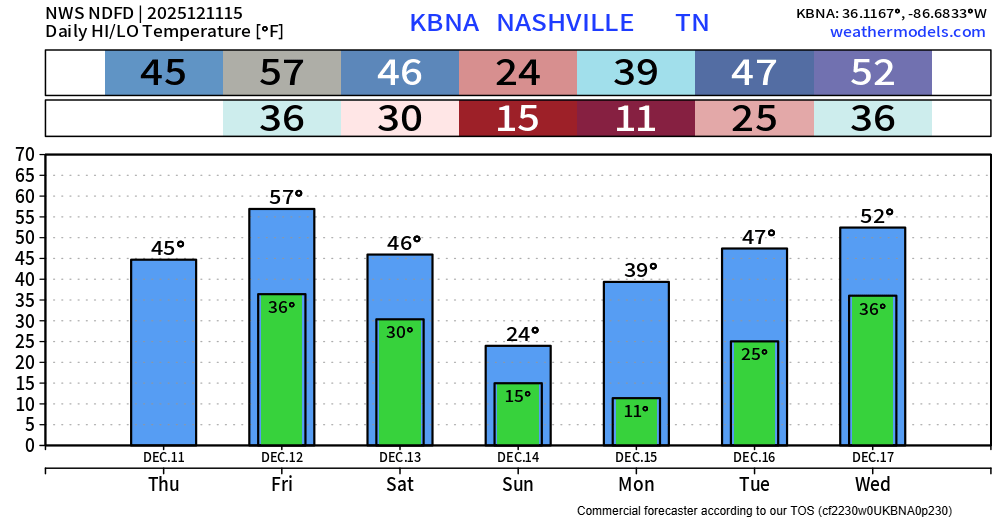
Saturday night we will drop below freezing and won’t get back above freezing until midday Monday.
Sunday morning we’ll wake up with temps in near 15, paired with wind gusts of ~20mph = wind chill values near 0°.
A high temperature of 24° on Sunday won’t feel much better. Wind chills will struggle to get out of the single digits.
Temperatures Monday morning will be ~10°. We finally get back above freezing Monday midday.
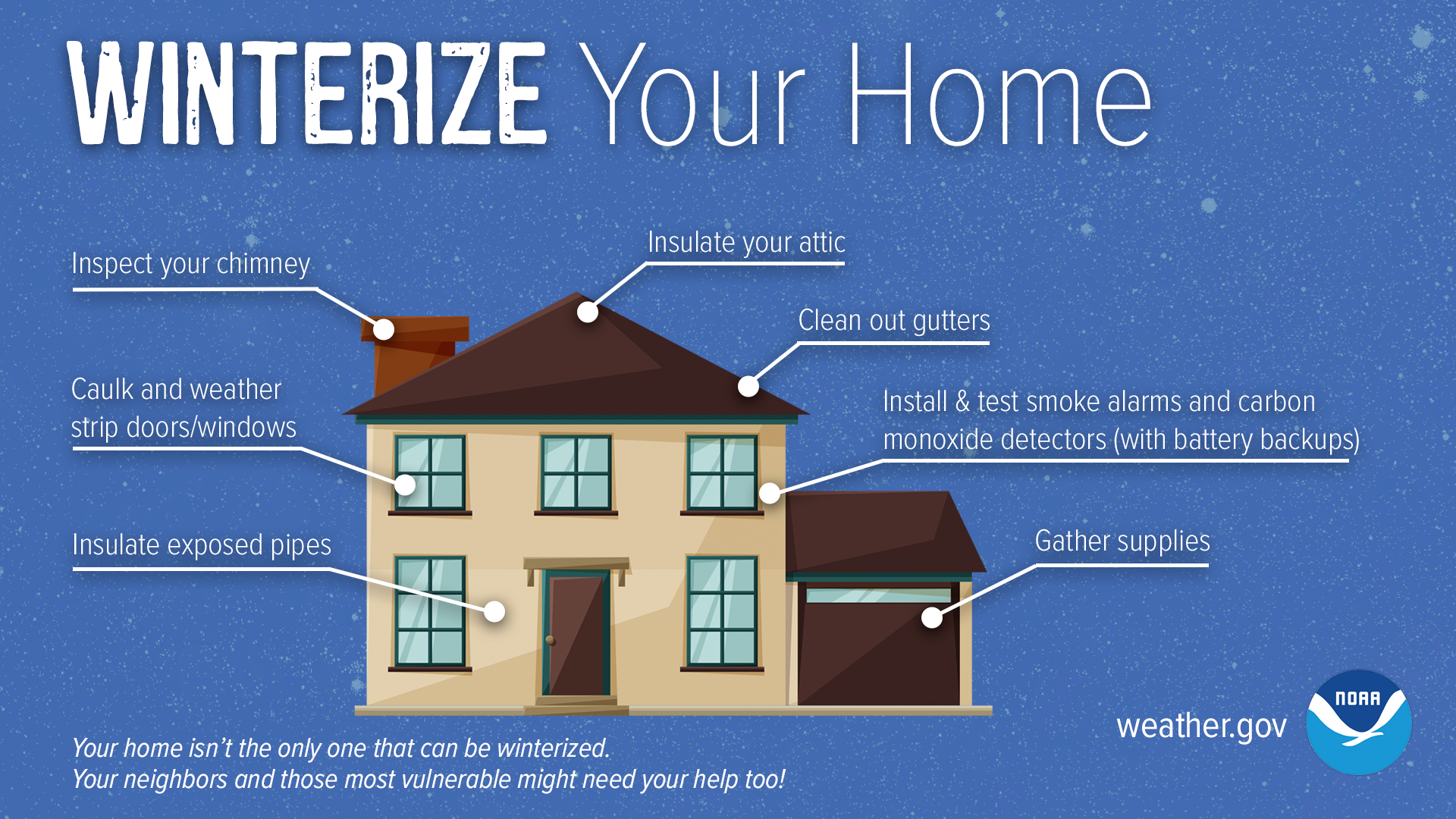
Now is the time to go ahead and start prepping your home for these temperatures. Insolate any exposed pipes and be prepared to drip your faucets.
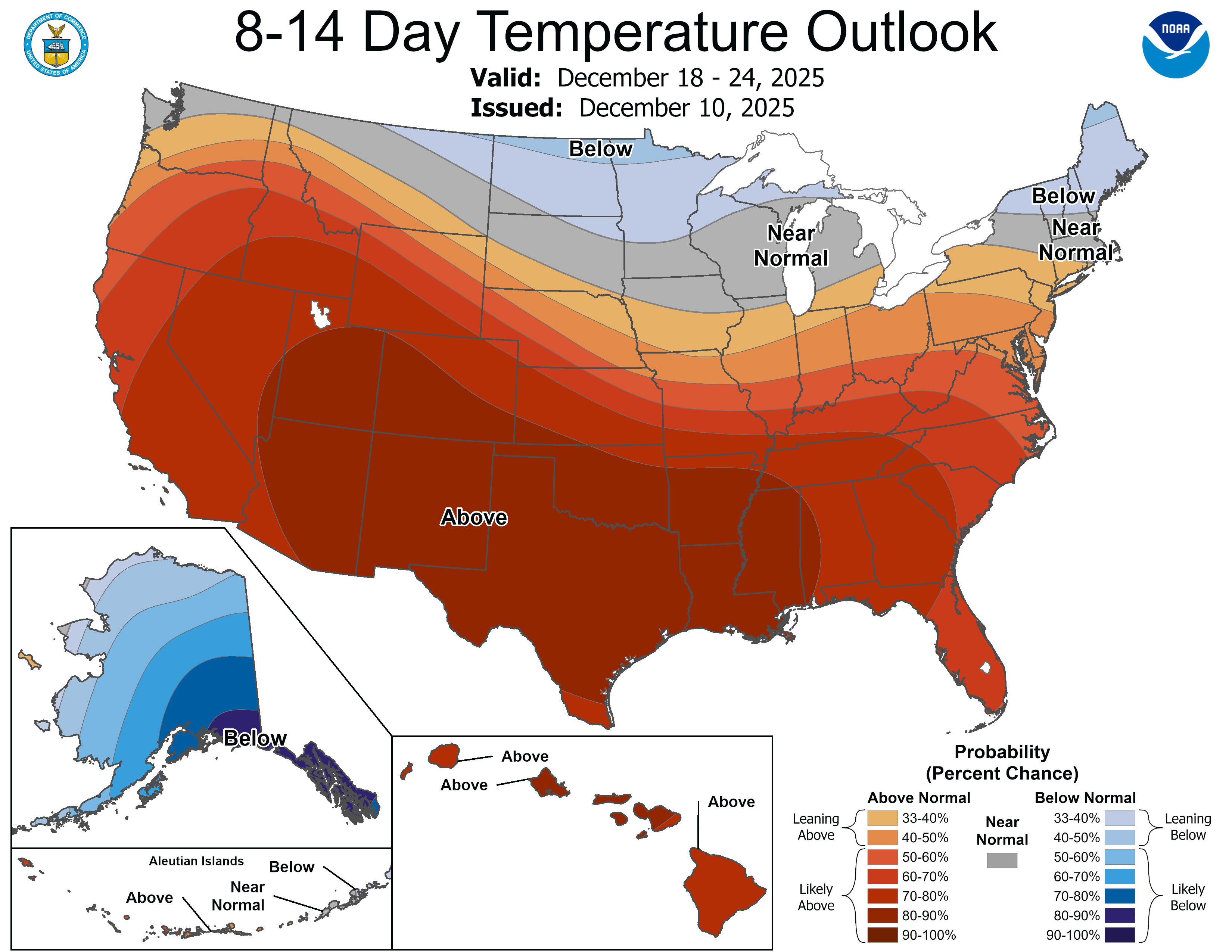
The good news is that this may end up being the coldest temperatures we see for the rest of the month. Long range models suggest warmer-than-average temperatures return in the 8-14 day range.
Categories: Featured Blog