
Scattered on/off showers will continue to move through both of our counties thru late this afternoon.
Wouldn’t be shocked if a few of us saw a thunderstorm around the lunchtime to early afternoon timeframe, but no severe weather is expected.
Rainfall totals have come down a good bit, as the heavier rainfall is expected to stay to our N in Kentucky. Generally, around 0.5″ of additional rain expected, amounts will vary though.
You can look at the radar anytime on our website here: Radar | Nashville Severe Weather
The cold front that is responsible for our rain today will push thru tonight and bring us drier weather, along with more seasonal temperatures.
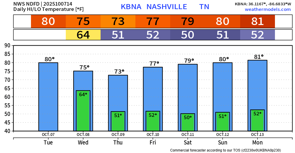
Highs in the mid to upper 70s, lows near 50° will be common thru the end of the week. I hesitate to call it Fall weather, but you can if you’d like. Highs back to 80° by the beginning of next week.
No additional rain chances thru at least early next week. October is normally the driest month of the year, so not surprising to see these dry stretches of weather this time of year.
Categories: Featured Blog