
Wattery coverage today has been less widespread than yesterday – but some of us still saw a decent shower.
High-res models think that’s it for us for the day, although I wouldn’t be totally shocked if we saw another shower or two.
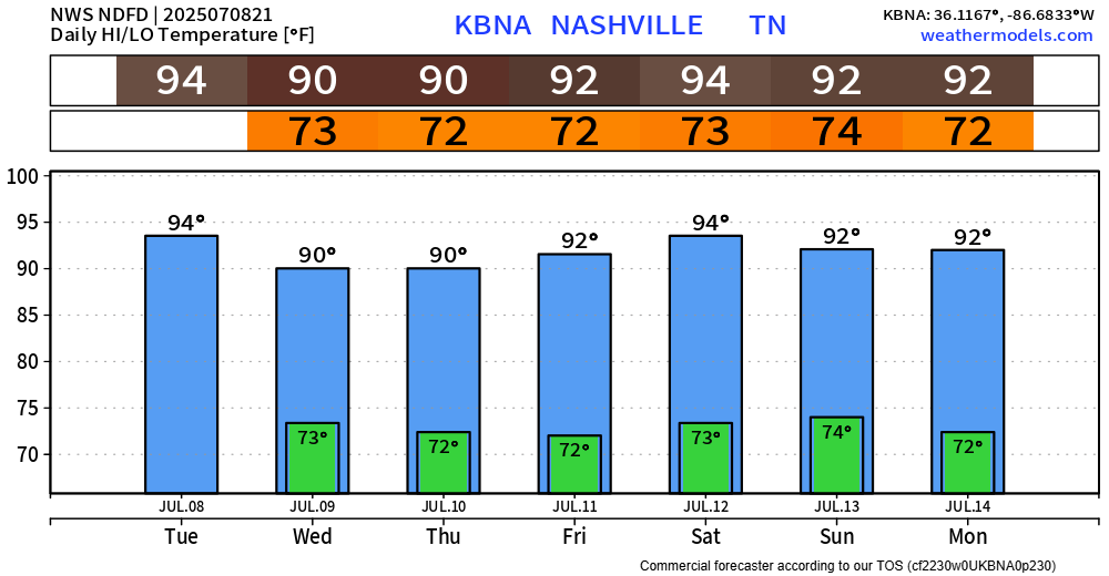
Our highest rain chances this week exist Wednesday and Thursday – although medium Wattery chances stick with us throughout the entire week, including this weekend.
Chances will be highest from late morning thru the early evening. No organized severe weather is expected, but the usual heavy rain, frequent lightning, and gusty winds will all be possible with a storm. Main concern will be the potential for isolated flooding with any heavy rain – especially in places that have seen loads of rain in the past couple of days. Please avoid any flooded roadways.
Impossible to know exactly when and where these showers and storms form each day, including this weekend. If you have outdoor plans – please stay weather aware and keep an eye on the radar. When thunder roars – go indoors. It sounds cheesy, but it may save your life.
Temperatures continue to do their normal thing for early July – hot. Heat index values will near 100° during the day if you happen to avoid a shower or storm. Please take breaks if you must be outdoors for long periods of time.
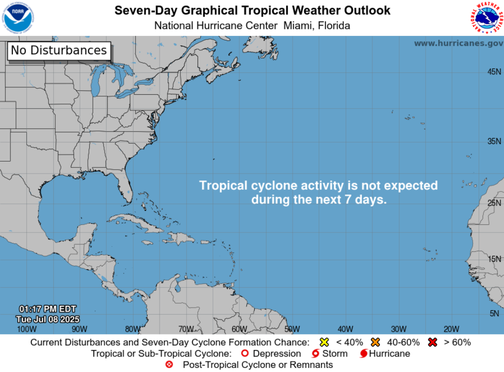
For those with tropical interests, all is quiet now in the Atlantic Basin. The National Hurricane Center has a great website you should bookmark if interested: National Hurricane Center
Categories: Featured Blog