
Monday:
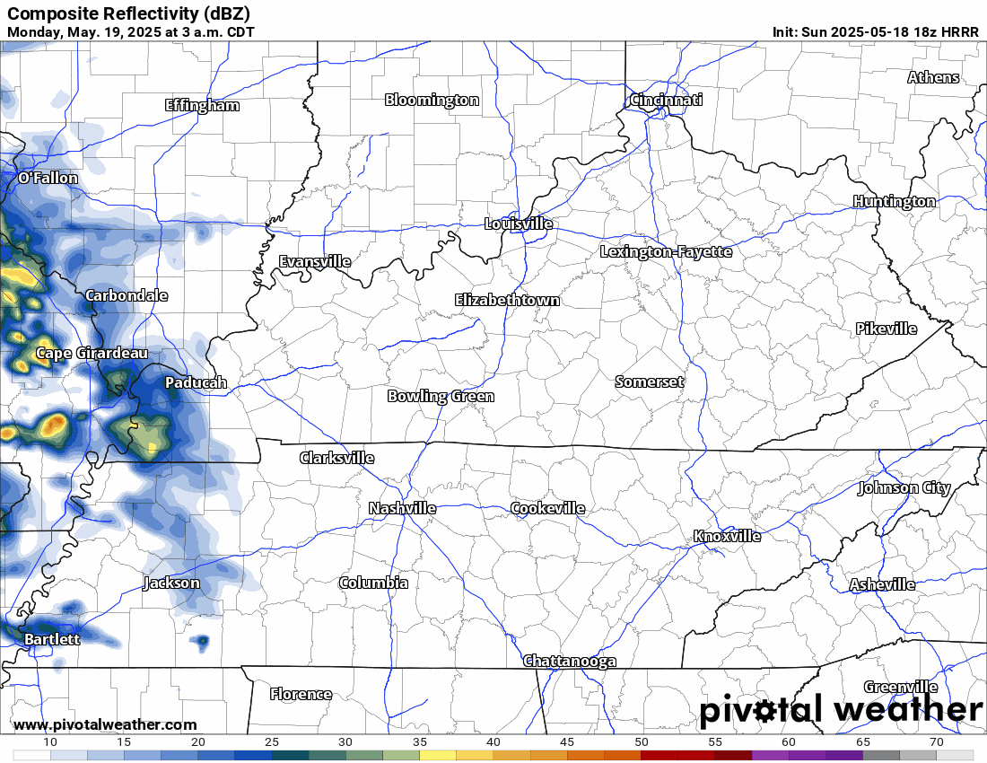
A few storms could bubble up before lunch and hang around through the afternoon. They’ll be hit‑or‑miss—so you might stay dry, or you might catch a quick downpour with small hail. Keep the umbrella and the radar handy, just in case. No big tornado vibes here, but gusty winds could knock small limbs around.
Here’s the HRRR for Monday
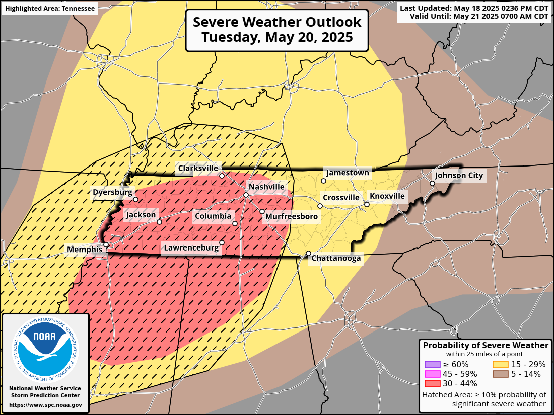
Tuesday (the one to watch):
A stronger system swings in. Think: sticky air, a fast‑moving cold front, and plenty of fuel for storms. We could see a couple of lone supercells first, then a line of boomers plowing through around the evening commute and into the late evening. That’s when the “all modes” talk comes in—damaging straight‑line winds, big hail, and yes, a spin‑up or two. Charge the phone, review your safe place, and plan for quick moves if warnings pop.
Wednesday:
Front scoots east overnight. Wake up to breezy, much cooler air—highs struggle to reach 70°, humidity takes a hike. Enjoy the break; yard work and patio lunches get a green light.
How to Get Ready
- Multiple alerts: NOAA Weather Is out this week. Set phones set to loud.
- Shelter plan: Lowest floor, interior room—practice with the fam Monday night.
- Outdoor stuff: Tie down trampolines & patio furniture before Tuesday afternoon.
- Driving: If you must travel Tuesday evening, know where you could duck inside quickly.
- Stay plugged in: Follow us and @NWSNashville on Socials.
Categories: Featured Blog