
- Scattered showers possible this afternoon and tomorrow afternoon. Lightning and rainouts the only hazards. Storm coverage should be limited Weds afternoon. Thursday probably dry, but hot.
- Summertime humid airmass expected Thu and Fri. Dewpoints in the mid 60s. First real one of the szn.
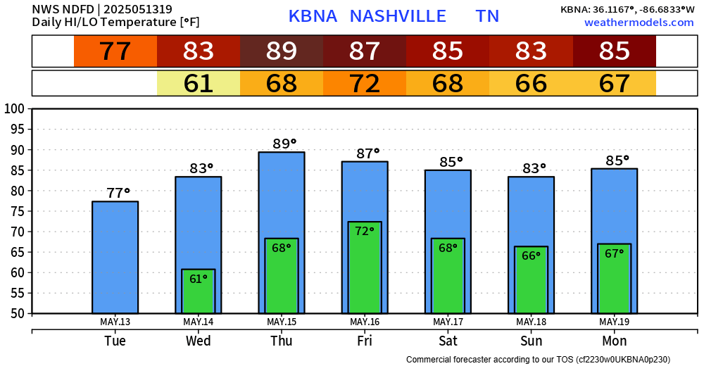
3. Severe weather possible Friday.
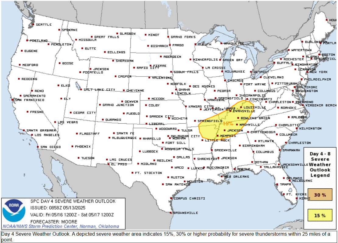
- SPC gave us a 15% probability of a severe weather event within 25 miles of any point in that yellow.
- Timing remains unclear. Best guess is a line Friday afternoon/evening. Uncertainties include whether there’ll be morning storms that reduce the storm fuel for later in the day.
- Damaging straight line winds and large hail are the most likely of any hazards. If we are quiet Friday morning and get this event in the afternoon/evening, lightningstorms will develop, waterloaded, putting weekend ball games in jeopardy. Not again, sigh.
- Tornado not impossible, but this doesn’t look like a tornadic event at the moment.
- An unstable airmass should remain throughout the weekend, scattering downpours and lightningstorms across the region.
Categories: Featured Blog