
This evening…
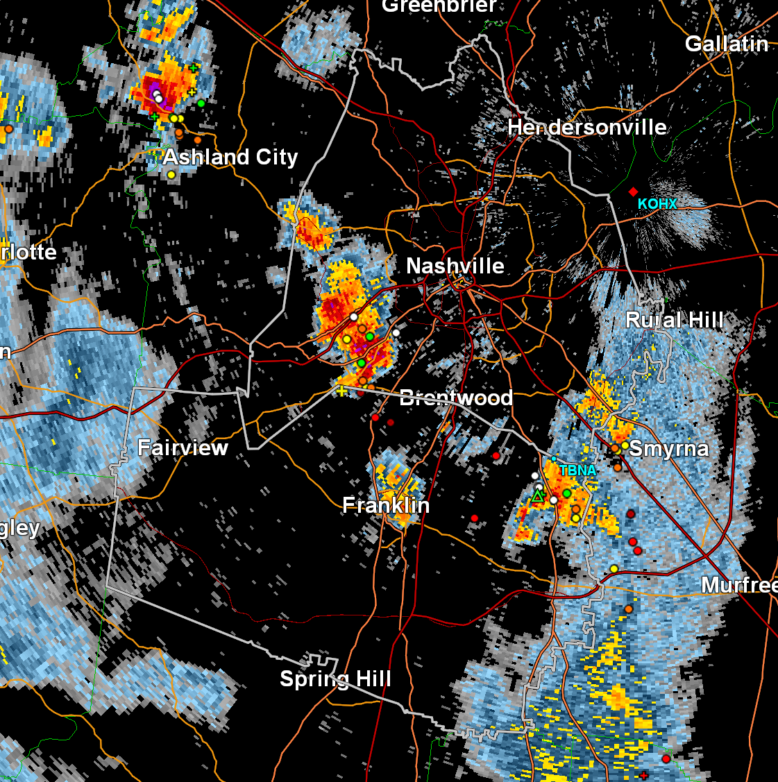
An upper low is spinning over the Lower Mississippi Valley and still has its hands in our weather. Daytime heating has cooked up CAPE (storm fuel) which has sparked storms. CAMs (those fancy short-term models we love) showed most of the action east of I-65 toward the Plateau. But this evening’s radar shows storms a little more widespread.
Any Severe Risk Today?
Low, but not zero. Weak wind shear = disorganized storms, but one or two rogue storms could punch up just enough to cause problems (think: gusty winds, hail). Slow storm motion (15 kts max) means if one parks over your backyard, it could drop a lot of rain in one spot — not enough for widespread flooding, but enough to watch closely.
Tuesday & Wednesday = Rinse & Repeat
Very similar setups. Hotter, humid afternoons = more pop-up storms. Not everyone gets wet, but if you do, be ready for lightning, heavy rain, and maybe small hail.
Turning Hot by Thursday
Upper-level ridging builds in, pushing temps toward 90°F by Thursday. Less coverage of storms expected, but…
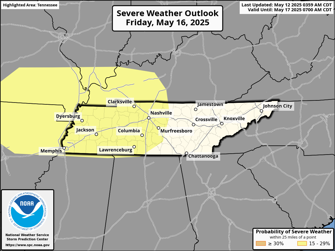
🚨 Heads Up for Friday
Friday is flagged by the Storm Prediction Center (SPC) for a potential severe event. Forecast models are showing big-time CAPE and wind profiles that could mean severe weather. Way too early for specifics, but Friday has our attention.
Weekend Outlook
Storm chances linger Saturday through Monday. Not a washout, but enough to mess with your cookout. Keep our radar handy. https://nashvillesevereweather.com/radar/
Categories: Featured Blog