
This is all the latest thinking – but weather changes. Stay connected for any updates to the forecast!
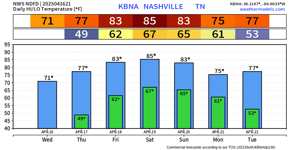
Thursday and Friday both warm and mostly dry. The only exception could be a few quick showers Thursday afternoon/evening, but these would be NBD. I don’t see these affecting any outdoor plans.
Yesterday, places along and N of I-40 were outlooked with the potential for severe weather on Saturday. The new update from the Storm Prediction Center has removed these probabilities from our area.
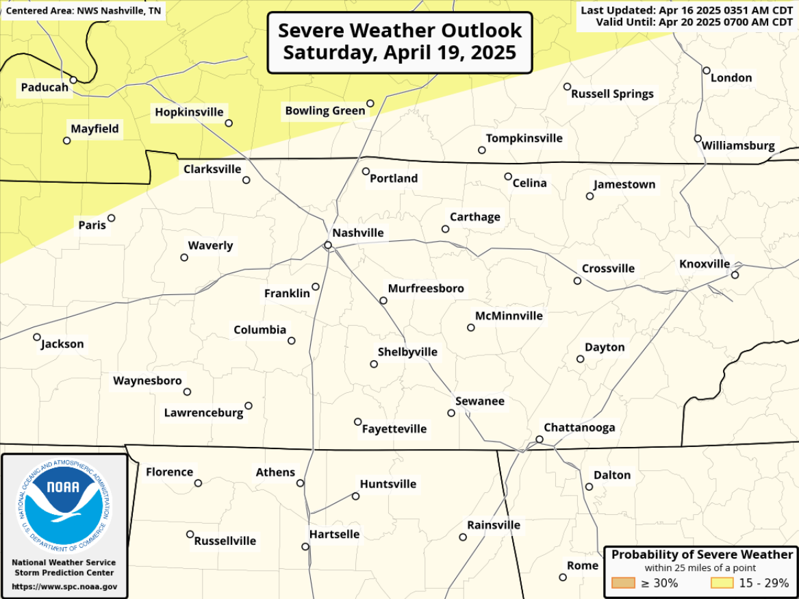
Why? As talked about yesterday, there was uncertainty about how far south the front would be able to make it. As of today, models are in solid agreement that the front does not make it this far south, therefore eliminating our severe worries. In fact, most models think we are totally dry Saturday. This could of course change, but right now any rain chances are very low.
Our rain chances don’t really pick up until Sunday evening or so, when a line of showers moves thru. I wouldn’t be shocked if we heard a rumble of thunder or two sometime Sunday evening thru early Monday morning – but no severe weather is expected as of right now.
In fact, the 5 latest runs of the Euro model (shown below) think rain holds off until at least after 7p on Sunday. This could change, but definitely good news.

Maybe plan on moving any Easter egg hunts a bit closer to lunch, but as of right now I think most of your weekend plans will be OK.

Rain chances will taper off throughout the day Monday. Warm temps stick with us.
Categories: Featured Blog