


A few may see frost early Sunday morning.
Winds a bit gusty Sunday and Monday afternoons. Gusts mid 20 MPHs.
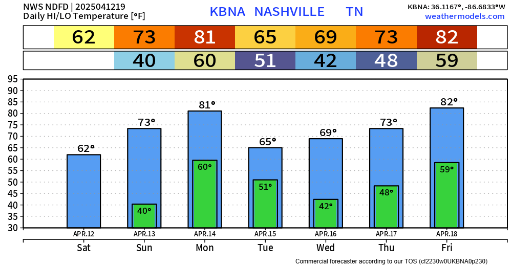
Rain possible late Monday night into Tuesday. Hi res models are out of range. Overall setup looks weak. “I’d be surprised to see a quarter of an inch of precipitation out of it,” said NWS Nashville.
Next potential rain event Thursday into Friday, maybe Saturday. Models have it mostly north of us although it’s trending south. Models are struggling on a consensus. This too appears meh.
Severe weather is not outlooked for the next 7 days. This is peak severe season so this is good news.
GFS and Euro models show rain/active weather after Easter.
 Log In To Facebook To Comment