

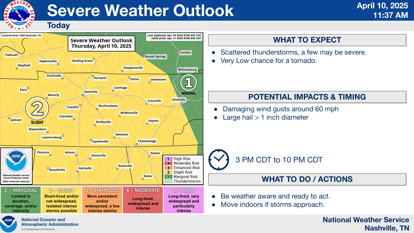
The Storm Prediction Center continues to have both of our counties outlooked with a 15% chance of hail (up to 1.5″) and/or damaging straight-line winds within 25 miles.
We have been removed from any tornado probabilities. The ingredients just aren’t there.
Timing:
It’s still hard to be super specific with timing because these storms may be scattered, but afternoon and evening still covers it.
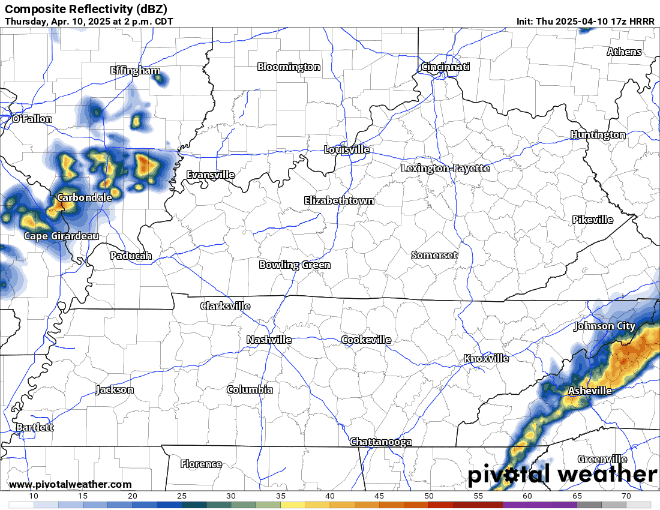
HRRR takes a swing at what the radar could look like – but it probably won’t look exactly like this.
Severe threat will end shortly after dark, if not before.
We’ll be keeping an eye on the radar and sending updates on our socials as needed. Stay weather aware! Hail and damaging winds can still be impactful.
We could see an isolated shower or two Friday afternoon, especially S of I-40, but chances are fairly low. Think your dinner/nighttime plans will be dry.
Saturday and Sunday look great. Mornings will be a bit chilly, but we’ll warm up nicely both days – particularly on Sunday. No rain chances.
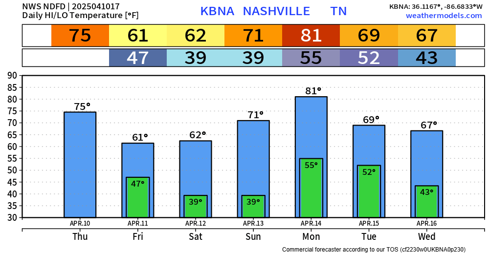
Very low (~15%) rain chances exist Monday PM. No other rain chances to discuss.
Categories: Featured Blog