
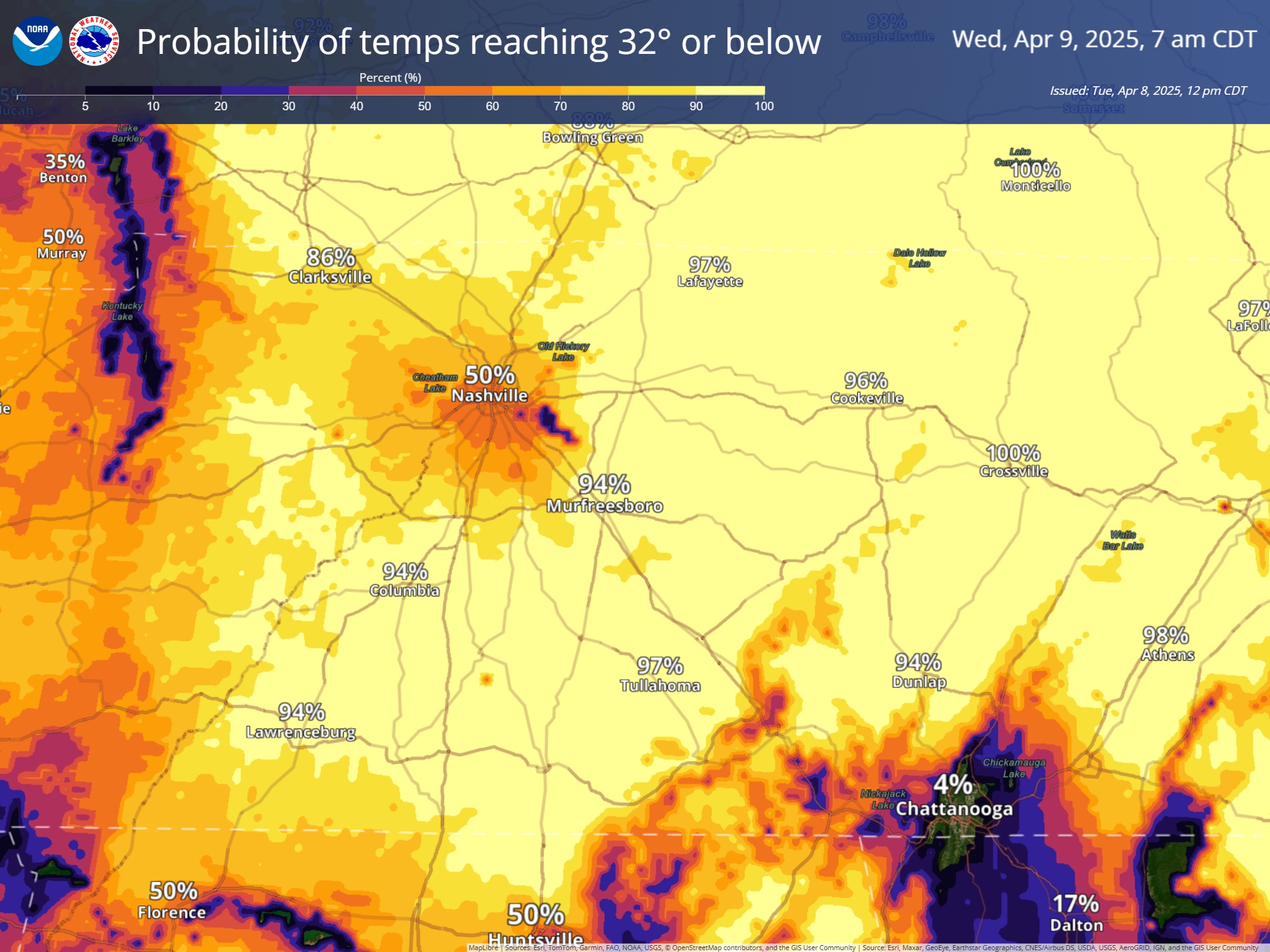
Lows tonight will yet again get down close to, if not below freezing. Cover up/bring in any loved plants!
Downtown Nash gets roughly a 50/50 shot of reaching 32°, with areas further away from the Urban Heat Island having much higher odds.
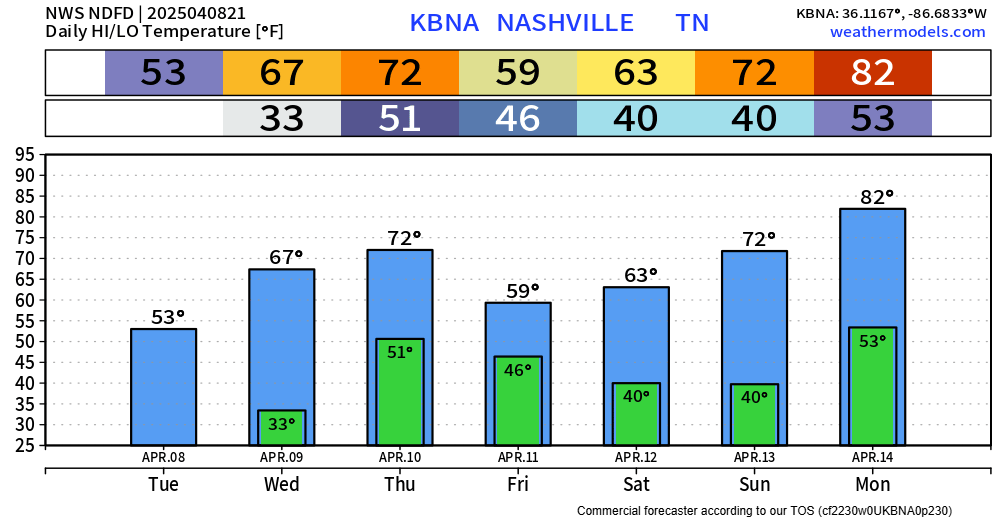
Tonight will be the coldest night of the week, but nights stay relatively cool.
Our only rain chances this week will be Thursday – but unfortunately, models have crept up on how much instability will be available, and the Storm Prediction Center have introduced very low probabilities of a strong to severe storm on Thursday.
The majority of the Tennessee Valley has a 5% chance of severe weather within 25 miles.
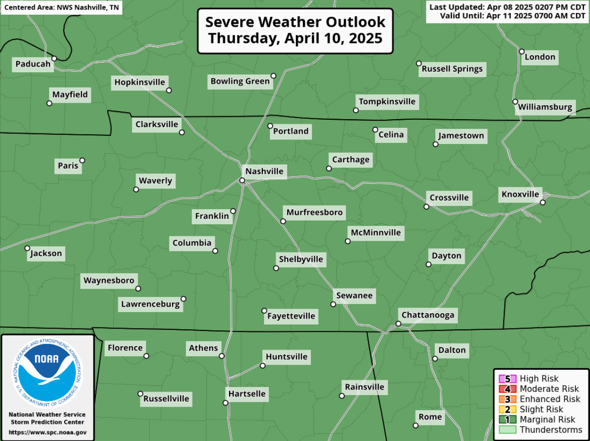
I will say, models still think instability (storm fuel) is fairly meh, lapse rates fairly high, but very little shear. This points towards a hail and damaging wind threat, not a tornado one. But still, this is a very low threat as of right now. We’ll keep an eye on it.
Timing wise, this looks like a midday thru evening deal. Rainfall totals look <0.25″ – not worried about any additional flash flooding.
In no way, shape or form does this look anything like we dealt with last week.
Friday, Saturday and Sunday all look dry. Temps near to slightly above average. Good weekend weather.
Categories: Featured Blog