

Models continue to struggle. Forecasters are ready to fire these models into the sun.
MORNING RAIN
This was the radar at 8 AM. All this rain is supposed to move north into Ky. as shown by the red arrows. But it’s also creeping a bit east — the white arrows — right over Davidson Co. Not sure how far into town it’ll get.
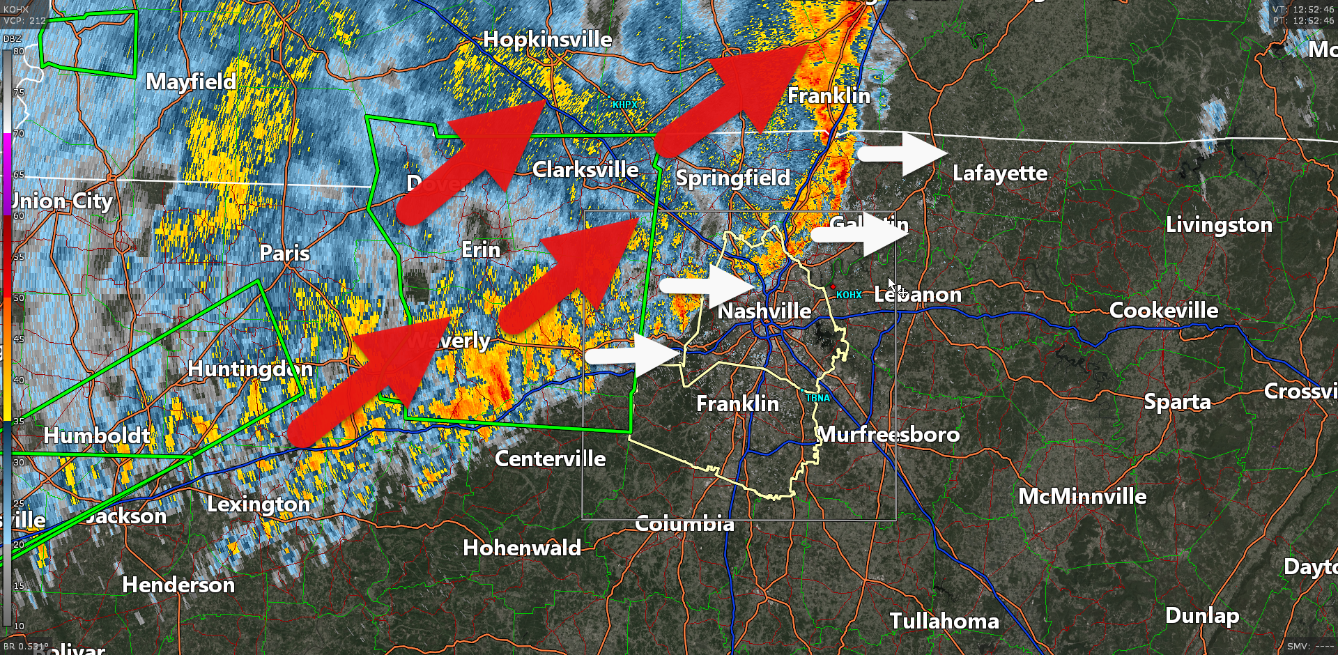
But we are not expecting severe weather with this morning convection. All it’s doing is frustrating local rollyball rainout decisions. You have a better chance of staying dry the further SE you go.
For what little it’s worth, the HRRR model — which went drinking last night — now seems to have sobered up. It illustrates the general idea of what we think will happen today.
- Our morning rain lifts north into Ky., following those red arrows.
- We will be dry this morning (most of us anyway) and most of the afternoon.
- More unstable, moist, air comes in behind it. Storm food.
- Shear increases. That’s not great.
- A front finally pushes in from the west.
- And we get a strong/severe storm event late this afternoon or early this evening.
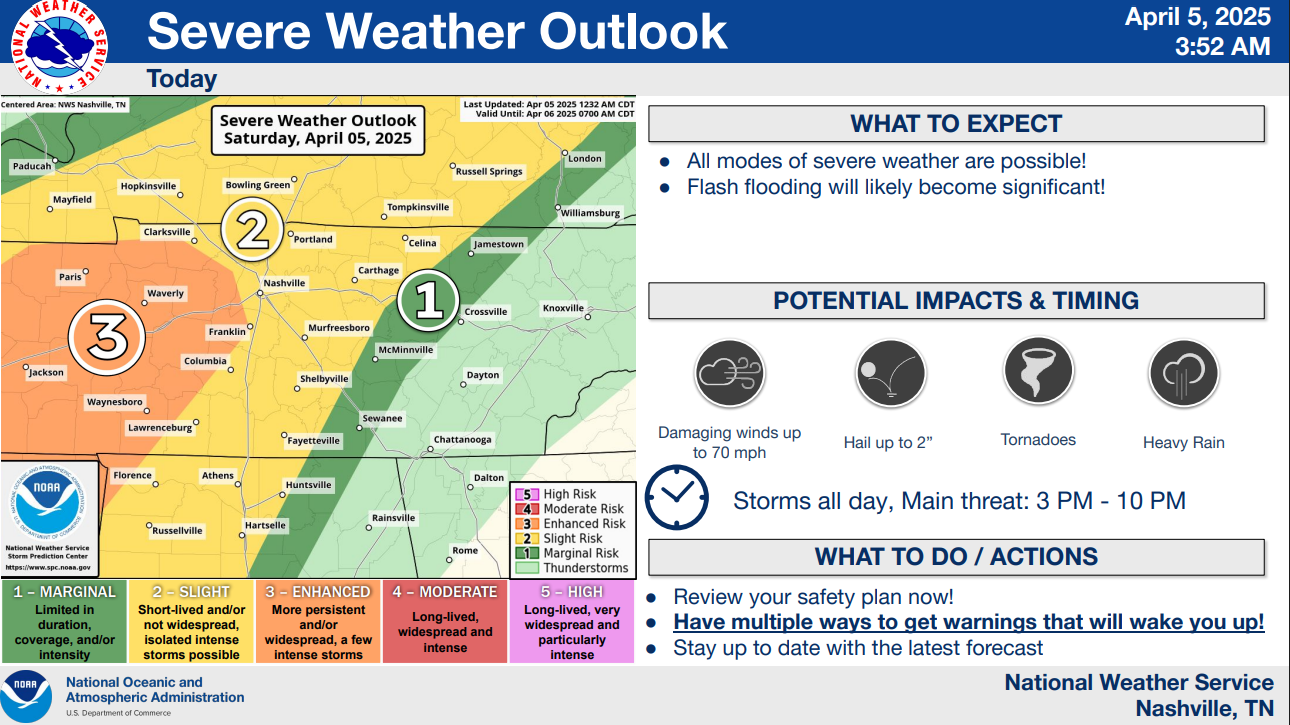
SEVERE STORM PROBABILITIES LATER THIS AFTERNOON/TONIGHT
Here’s the big graphic for the late afternoon/evening event.
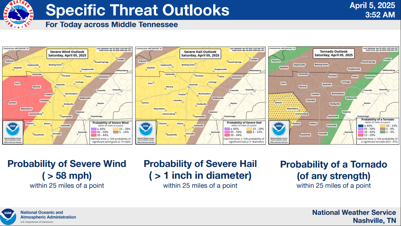
And the probability of hazard breakdown (this’ll get updated a few times today). Good news is that the tornado outlook right now appears to fall off before it gets to us: only a 5% probability within 25 miles of us.
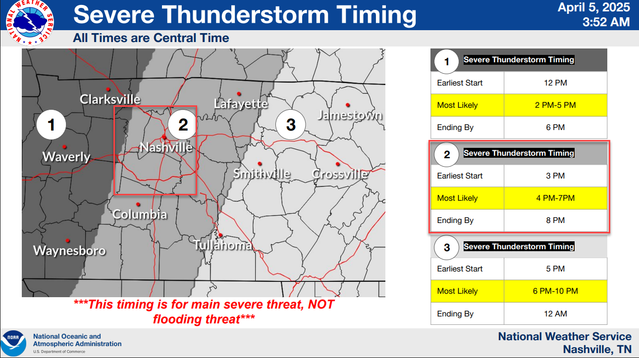
Timing range for us is 3 PM earliest to 8 PM latest, most likely 4 PM to 7 PM. This may need to be updated later.
No late/overnight bang bang storm threat tonight, and we think this will be the last severe thunderstorm threat for a while. More peaceful Sunday. But we are
CONCERNED ABOUT FLOODING
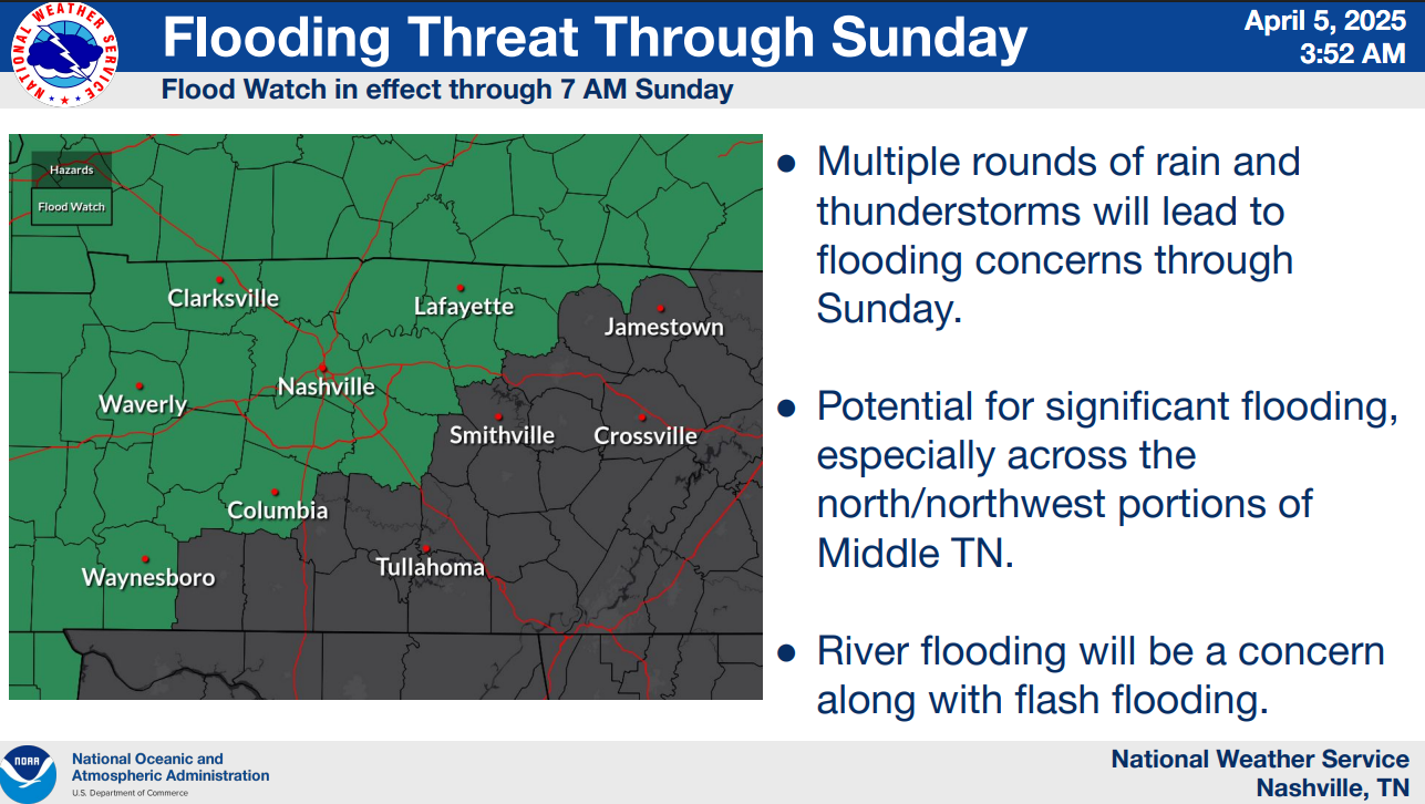
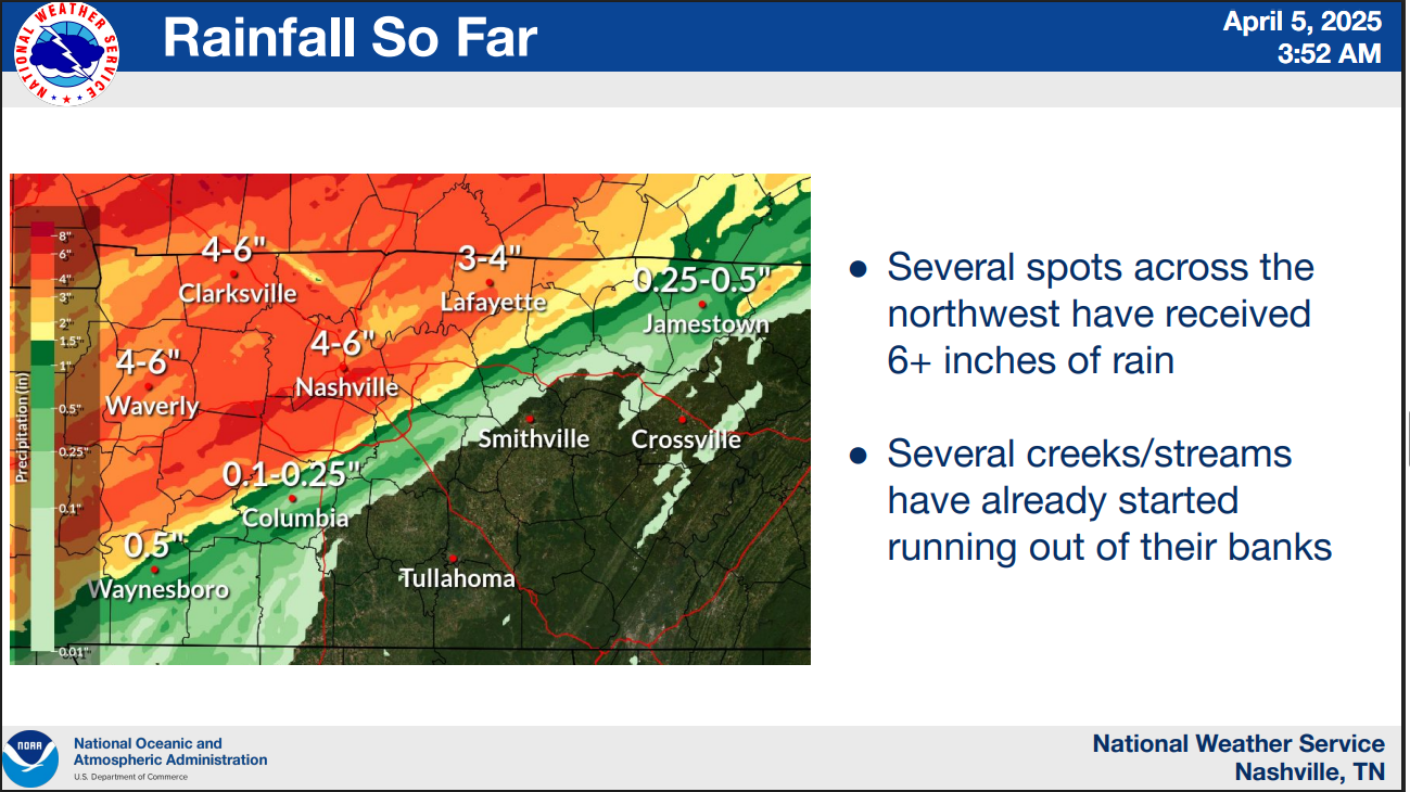
We have already seen a LOT of rain from the stationary front over the past several days. We can’t take much more water.
We may see an additional 3″ to 4″ today and overnight. That’s too much.
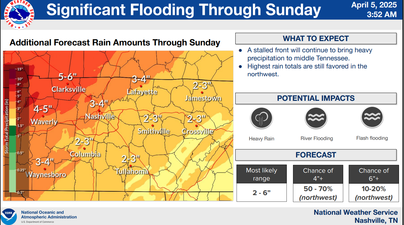
Area creeks and rivers may rise again tonight, overnight, and into Sunday. This is a concern for drivers and those in low lying areas. Avoid water covered roads.
NOTES
Tornado sirens may be tested this afternoon. I hope not but note I don’t see a scenario where we get lunchtime tornadoes.
This forecast may change. We’ll update it throughout the event on Twitter/X, Blue Sky, Threads, and Instagram. We’ll be on YouTube Live if we get a severe thunderstorm or tornado warning.
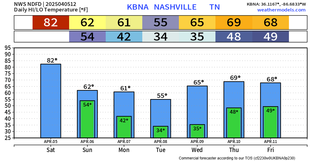
Cooler temps Sunday through the week. Frost and even a freeze is possible Tue. and Weds. mornings.
Categories: Featured Blog
nice