
Still watching Tuesday for severe storm potential – but the overall chances have come down.
The Storm Prediction Center has outlooked areas S and W of I-24 with a 5% chance of severe weather within 25 miles. This could (probably will) change between now and then.
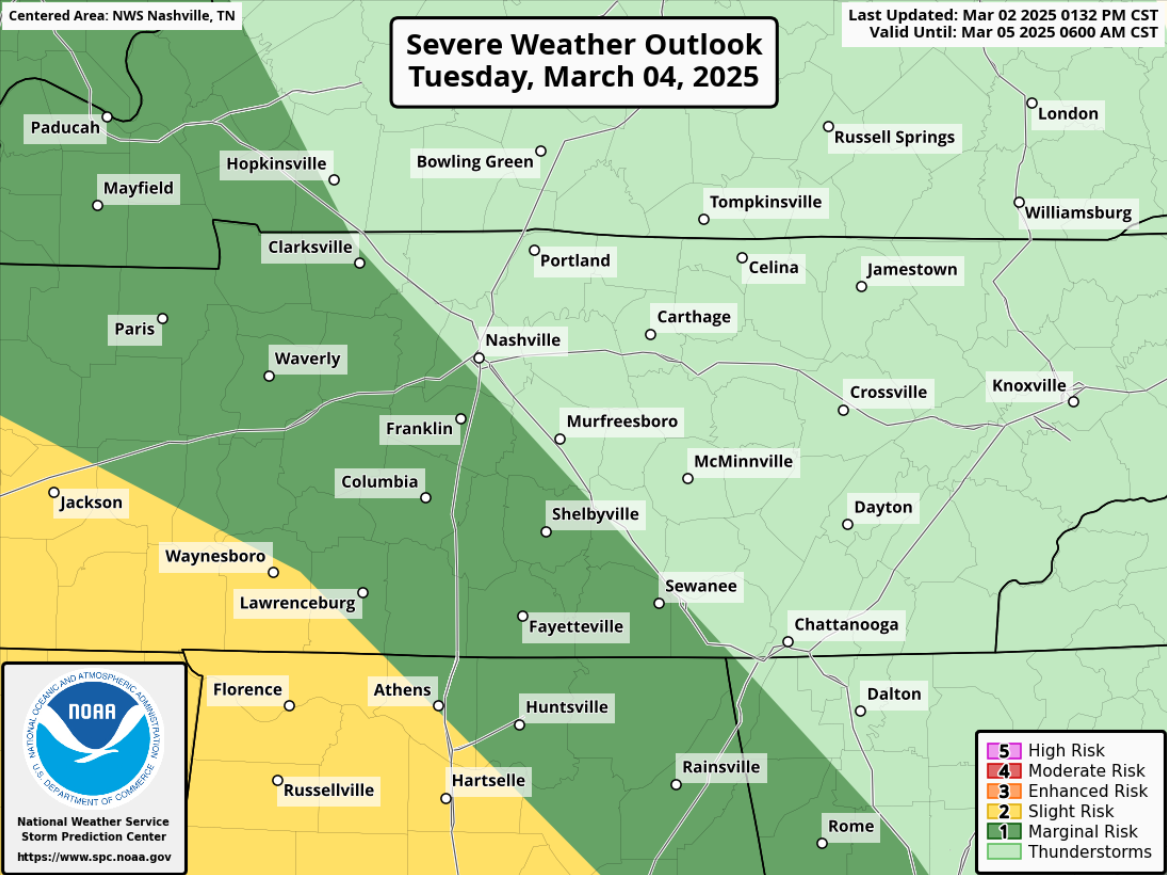
Moisture and instability continue to look quite lackluster (or just missing completely) on Tuesday, reason for the downtrend in our severe weather potential.
This is still something that should be watched. High-res models will come into view shortly to give us a better glimpse.
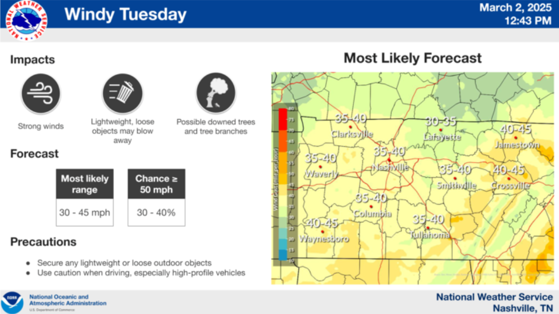
Regardless, we are still expecting some heavy rain along the line of storms Tuesday evening/night.

Before the rain during the day Tuesday, we’ll see some strong winds thanks to a tight pressure-gradient. Wind gusts near 40 mph will be possible.
Secure any outdoor furniture before then and beware of your trash can ending up down the street.
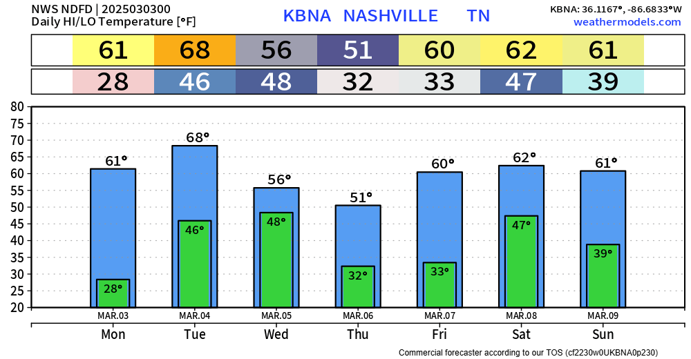
Next rain chances come around next weekend.
Temperatures fairly seasonal over the next week.
Categories: Featured Blog