

We have been outlooked by the Storm Prediction Center with:
- a 5% chance of damaging straight-line winds within 25 miles
- a 2% chance of a tornado within 25 miles
for Wednesday – Thursday morning.
Although this is relatively a very low threat for severe weather, it isn’t zero – so let’s discuss.
Tomorrow throughout the day, moisture and instability will gradually increase – especially as we get closer to the evening.
This, along with an increase in shear will help set us up for our low-end severe weather threat. Although the CAPE (storm fuel/instability) and lift do not look particularly impressive – thus, the fairly low + conditional threat, but not zero.
“Even with all the limitations, mention of the severe risk seems reasonable given the conditional potential- meaning IF any strong cells form and become surface based, strong wind gusts will be possible and unfortunately, a tornado cannot be ruled out…” – NWS Nashville Area Forecast Discussion
Timing:
Latest models indicate that our timeframe for any severe weather potential would be from 10p Wednesday – 6a Thursday. Timeframe is broad right now due to some uncertainty and is subject to change!
The 18z HRRR model gives its best guess, loop goes from 11p Wednesday thru 11a Thursday.

Note: We could also see some rain, maybe a thunderstorm, Wednesday afternoon thru early evening but not concerned about severe weather with this “round.”
On/off showers could also continue thru the day on Thursday – but think the severe threat will diminish due to our atmosphere getting worked over – although this will have to be watched.
What To Do:
Keep an eye on the forecast! We are still 24+ hours out from this event (or non-event), and a lot will likely change between now and tomorrow evening. More model data will be coming in to give us a better idea of things, and confidence will increase.
It’s been a while since we’ve dealt with any severe threat – and with this potentially being an overnight thing, now is a good time to check those Weather Radios, your wake-me-up apps and to make sure your Wireless Emergency Alerts are turned on. You might not need it tomorrow, but Spring is slowly approaching!

More rain/storm chances arrive Saturday/Sunday, but we are not outlooked with any severe chances right now. More deets on this later.
Temperatures will continue to be above average until Sunday, when we all get a reality check.

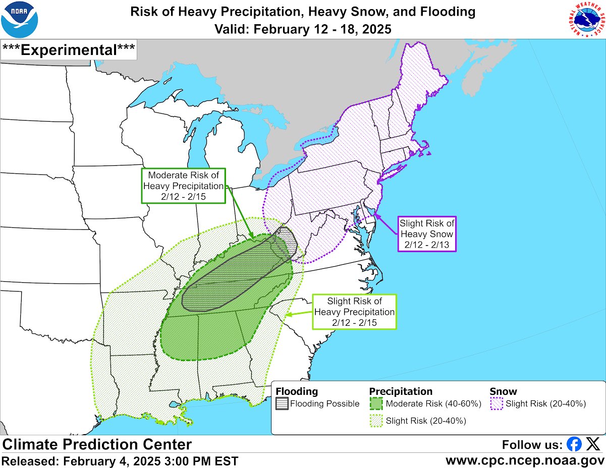
The Climate Prediction Center is calling for an unsettled and active weather pattern mid to late next week – highlighting us with a 40 – 60% chance of Heavy Precipitation, and some flooding potential from the 12th – 15th. This is quite a way out there, but something to keep an eye on.
Categories: Featured Blog