
Temperatures are beginning to fall and will soon dip below freezing. If the forecast holds true, they will not rise above 32° until around 10am Thursday morning. That’s about 104 hours at or below freezing. Your mileage may vary.
For tonight, models are picking up on some intermittent snow showers late tonight into tomorrow morning. HRRR loop from 1am Sunday through noon.

“For most of Middle Tennessee, accumulations will be light and varied, mostly less than one half inch. A few slick patches may develop on elevated surfaces like bridges,” says NWS. This does not appear to be capable of widespread problems….but problems don’t have to be widespread to cause you a headache. Be cautious traveling Sunday morning.
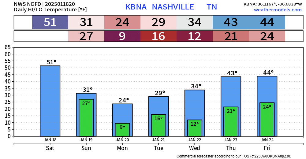
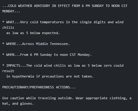
Of the bitter cold incoming, the worst conditions appear to be overnight Sunday night into Monday morning, when temps drop into the single digits and highs only strive for the low to mid-20s. Hence, this Cold Weather Advisory from our NWS:
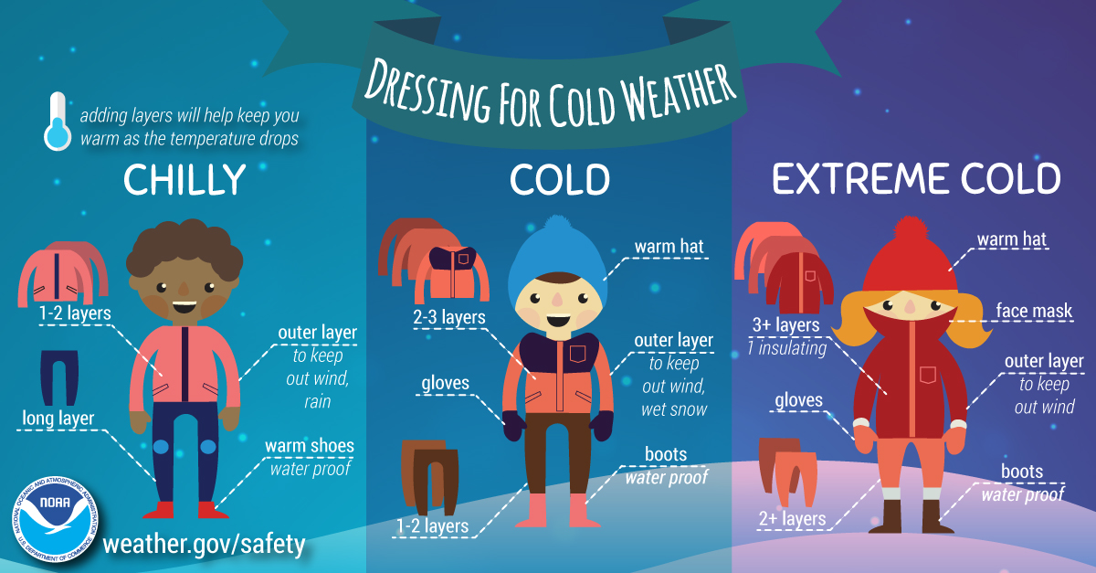
Prepare for this cold before leaving home or work:
Once we climb above freezing Wednesday, things look pretty quiet for a few days. Let’s get through this cold. Check on those around you who could be vulnerable. Let’s take care of each other.
Categories: Featured Blog