
Our cooler temps are here – and here to stay for a while.
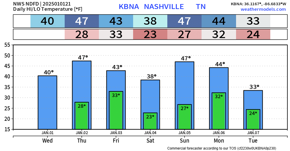
Our highs + lows will likely be below average for at least the next 7 days, and beyond. Colder temperatures likely later next week. Some models suggest we don’t get above freezing much at all next week after Monday.
The weather-maker that we’ve been watching for several days still appears to be arriving Sunday.
While there is still plenty of uncertainty, there is a bit more agreement upon the models in regard to what type of precipitation we are expecting.
As of right now, the current general agreement amongst majority of the models is Scenario #1, with the low-pressure system tracking just to our north, likely leaving us with mostly rain.
Below shows what 5 different models think the radar might look like Sunday evening. All indicate us being on the “warm” side of things, with mostly liquid precip falling.
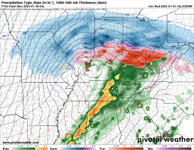
By no means is this set in stone, and things could change. However, this is pretty decent agreement among the models right now. Still, will be watching for any trends north or south.
We could see some flurries on Monday as the moisture pulls out of the area, but no impacts are expected.
We’ll get a break from any precip for a few days before another system is expected to stroll through the southern US sometime mid next week. Still a ton of uncertainty with this as well, one system at a time.
Categories: Featured Blog