


“We expect some light accumulations tomorrow afternoon mainly north of I-40 and east of I-24 as an upper trough swings across Middle Tennessee. Despite high pressure building in at the surface, there does appear to be enough moisture and lift aloft to product some light snow with accumulations up to 1/2″ possible.”
NWS-Nashville forecast discussion 12/1/24
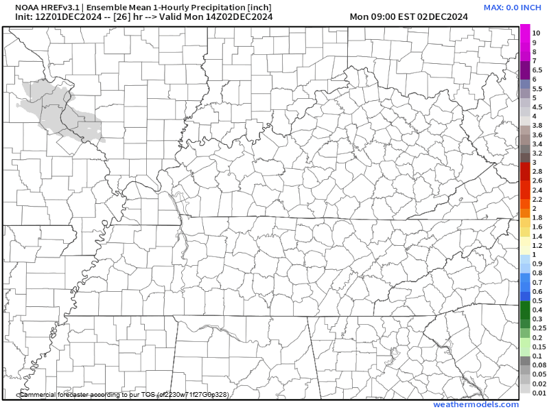
The HREF Ensemble weather model is below. It shows light moisture to our NW. It’s that grey blob moving SE. As it approaches us, the snow falls apart.
The HRRR weather model below shows a bit more snow …
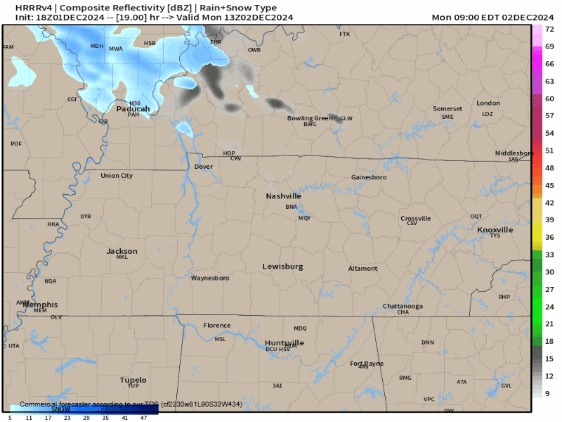
… as a grouping of light flurries arriving Monday afternoon/early evening. Some of this snow will evaporate as it falls through drier air (if you prefer: eaten by the Dry Air Monster). Whatever is left should fall, settle, and melt on the warmer ground.
Mailboxes and garden gnomes may develop sky dandruff. Areas at elevation may see a few flakes on the ground. That’s about it.
Stay connected for updates/changes but I don’t expect revisions to impacts.
There are some additional rain chances Wednesday night with the next cold front. But moisture accompanying this system will be scant and QPF values are very low.
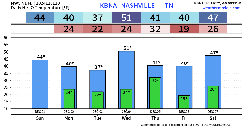
Temperatures throughout the first week of December are going to be quite cold, definitely colder than normal, and this trend is likely to continue in the 6-10 day period and perhaps even days 8-14.
NWS-Nashville forecast discussion
 Log In To Facebook To Comment