Wind gusts up to 20 – 30 mph have been common today, and will continue to be thru Friday as cooler/drier air is ushered in.
Our next several mornings will be the coldest of the season thus far.
Thursday 7a Temp/Wind Chill: 38°/31°
Maybe some occasional mist throughout the evening, but the majority of the rain is gone.
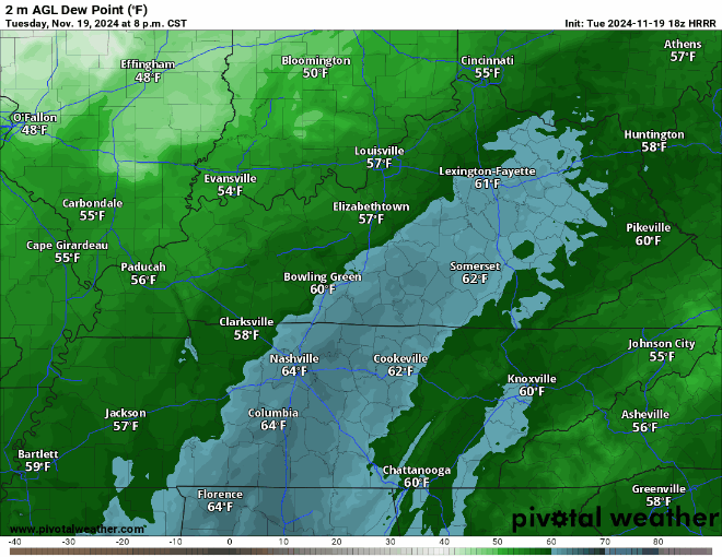
As of 5:45p, dewpoints are in the low 60s across the area, this time tomorrow they will be in the low 30s.
Wind gusts from the NW up to 30 mph (possible Wednesday – Friday during the day) will aid in getting this much colder and drier air mass into our area.
Nice and seasonally warm day today, even warmer on Sunday and Monday with highs reaching into the low 70s.
The low 70s stick with us on Tuesday, however rain chances will return.
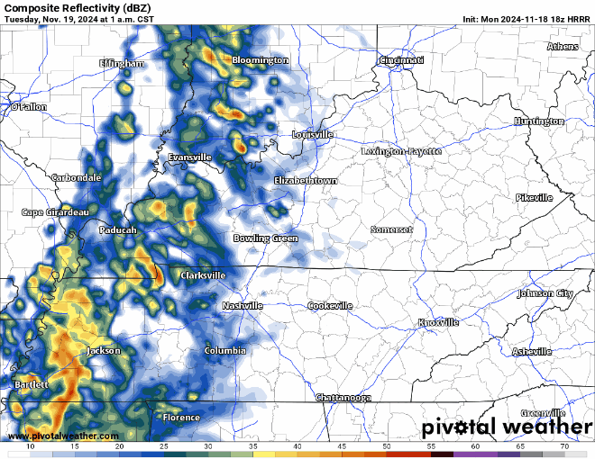
For now, scattered showers (and maybe a rumble of thunder) will be possible, most likely during the first half of Tuesday. No shenanigans expected, rainfall totals will generally be light around 0.25 – 0.5″.
The cloud cover was stubborn today, keeping temps fairly cool, but at least we are dry.
We are in store for some great HS playoff football weather tonight. Temperatures near 50° for kickoff, getting into the upper 40s by the 4th quarter. For players, this is nice. For those in the stands, a jacket will be your friend.
A very nice November day today, unfortunately the same cannot be said about tomorrow.
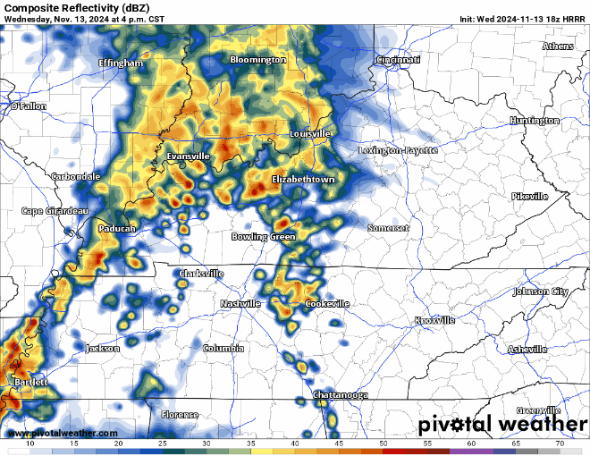
HRRR model (below) shows how most model thinks Wednesday plays out…

No severe weather expected! Maybe a rumble of thunder though. Good rain to sleep to.