
Maybe some occasional mist throughout the evening, but the majority of the rain is gone.
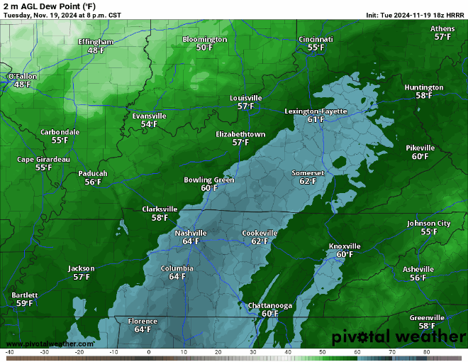
As of 5:45p, dewpoints are in the low 60s across the area, this time tomorrow they will be in the low 30s.
Wind gusts from the NW up to 30 mph (possible Wednesday – Friday during the day) will aid in getting this much colder and drier air mass into our area.
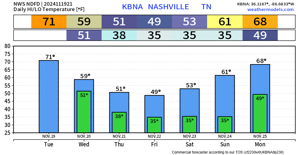
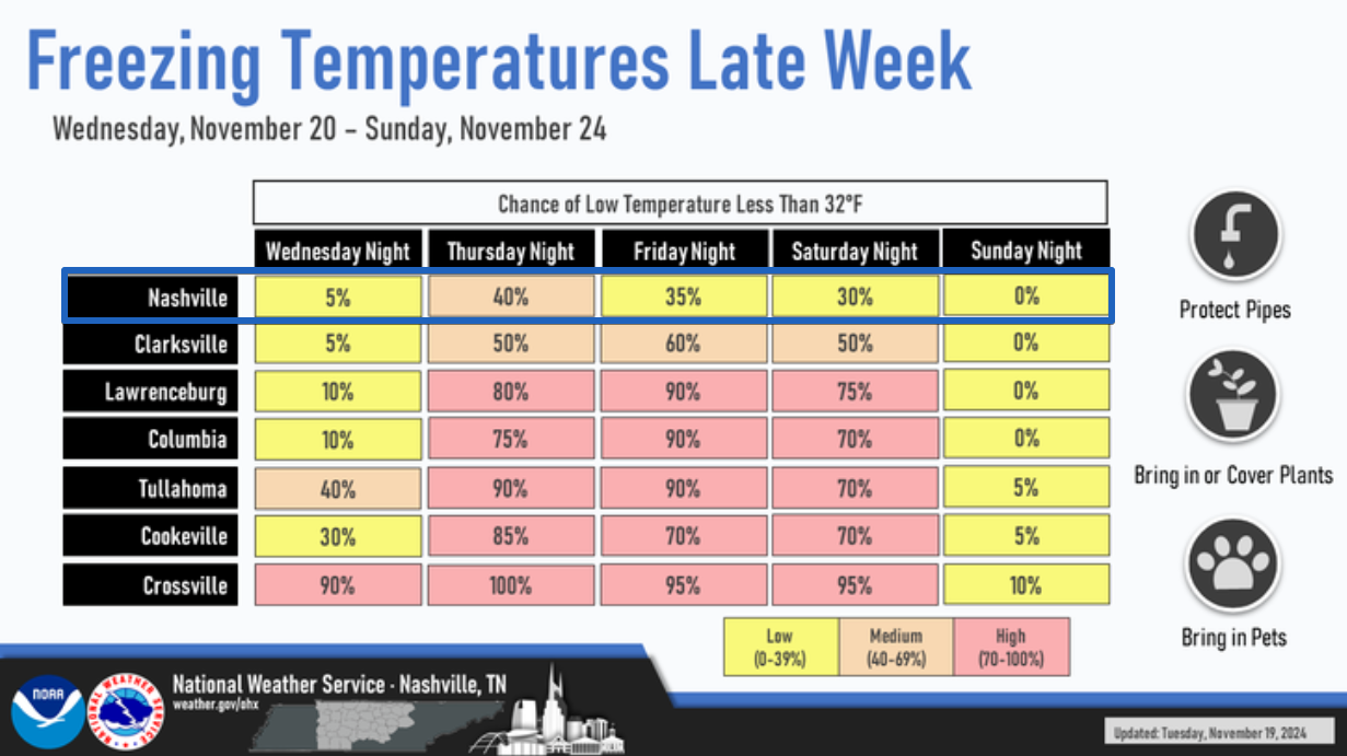
Still appears as if we will be getting close to freezing Thursday night, Friday night, and Saturday night. Nashville Metro usually a few degrees warmer than surrounding, more rural areas, so local backyard temps will differ.
Sunday temperatures begin to start warming back up as southwest flow returns. Rain chances also look to return sometime early next week.
Thanksgiving forecast? Early predictions say unsettled.
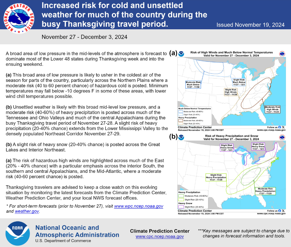
That has a lot of words.
To keep it short and sweet, the Climate Prediction Center shows a 40-60% chance of High Winds from 11/27-11/29, and a 40-60% chance of Heavy Precipitation (in the form of liquid rain) from 11/27-11/28. It’s still too soon to start talking about specific impacts, but something to keep in mind for Thanksgiving related plans, including travel. We’ll keep ya posted.
Categories: Featured Blog