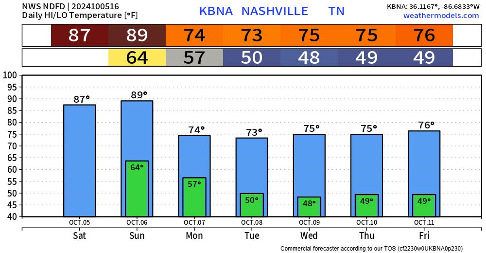
Today and Sunday will be our last “hot” days for the foreseeable future. Upper 80s today, even pushing 90° tomorrow.

A cold front will push thru Sunday night, escorting cooler and drier air – making it feel more like October.

The cold front may be able to squeeze out a quick shower or two, but that looks unlikely.
All of next week looks dry.
For those headed to the Florida peninsula for Fall Break, a tropical storm is expected to form over the next day or so and make landfall sometime Wednesday as a hurricane. Be sure to stay connected with any updates from local NWS offices and the National Hurricane Center.

Categories: Featured Blog

