

There have been some minor changes to our expected local impacts from Francine. Changes to this forecast are very possible, be sure to check in for updates!
Francine is still expected to make landfall as a hurricane sometime Wednesday afternoon/evening along the coast of Louisiana and make its way up to our neck of the woods as a Tropical Depression.
Impacts may begin as early as Thursday morning and continue through the weekend.
The main thing we will be watching will be rainfall totals. The track of Francine has moved slightly eastward, bumping up our expected rainfall totals a tad.
The latest expected rainfall totals from the best at NWS Nashville show 3 to 5 inches possible thru Monday night.
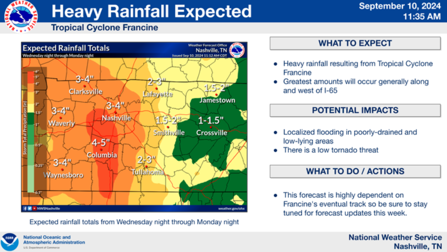
Our area can handle that amount of rainfall if spread out enough, however if heavy rain “trains” over the same area(s), we could be looking at a localized flash flooding threat for some.
The heaviest rainfall is expected to fall Thursday PM into Friday. Still not married to this timeframe, but it is the best guess as of right now.
The tornado threat still appears low, but not zero.
“A few cells could have the propensity to rotate late Thursday into Friday. The low instability values could limit the tornado threat though.” says NWS Nashville.
Models continue to indicate CAPE values (storm fuel) being very low, which will help keep our tornado threat quite low, but these tropical systems tend to bring a lot of wind energy, which will make a brief, weak tornado or two possible.
With the expected path of Francine shifted a little towards the east, some gusty winds will also be possible Thursday + Friday, with gusts up to 30 to 35 mph possible.
Rain chances will stick around Saturday into at least Monday with tropical moisture hanging around our area, although chances will be lower than Thursday & Friday.
This forecast could very well change depending on the track Francine takes, continue to monitor for any updates, especially if you have outdoor plans!
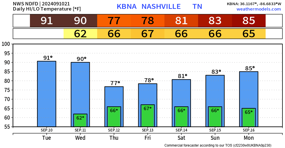
At least the rain will bring cooler temps and help with our ongoing drought.
Categories: Featured Blog