
Most models think a cluster(s) of showers/storms will be moving thru around rush hour Friday AM. The HRRR model thinks it’ll look something like:
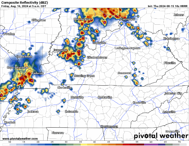
Models are in fairly good agreement that these should be below severe limits. Although heavy rain, lightning and gusty winds will still be possible, just not really concerned about this – forecast could change.
Another round of storms will be possible Friday afternoon and evening, but this round has several question marks behind it.
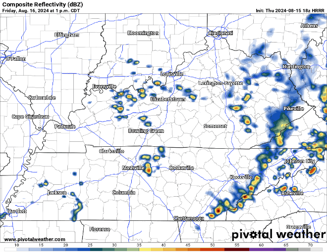
Most models (including the HRRR shown above) think storms fire off just to our south, missing us. However, models could be wrong! The Storm Prediction Center has both of our counties outlooked with a 5% chance of damaging straight-line winds within 25 miles. We are not outlooked for hail or tornadoes due to insufficient wind shear.
Saturday we are yet again outlooked with a 5% chance of severe storms within 25 miles, for the threat of damaging straight-line winds in the afternoon and evening – although there is still a good bit of uncertainty.

The Euro shows a line of storms around lunchtime Saturday, with scattered activity thru the evening. This is just one run of one model and could be wrong. Deets will become more clear in the next day or so.
Some lingering showers can’t be ruled out for the first half of Sunday, but we all should be dry by Sunday afternoon. First half of next week looks dry.
Dewpoints in the mid 70s Friday and Saturday will make for some uncomfortable afternoon heat.
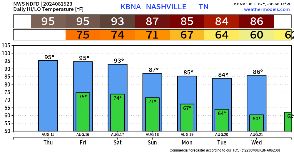
Good news is that temps will be slightly below-average for the beginning of next week and dewpoints return to comfy levels.
Categories: Featured Blog